March 1944 - (A.A.F.) U.S. Army Air Force Life Raft Current Map - North Pacific Ocean - Limited Print Edition


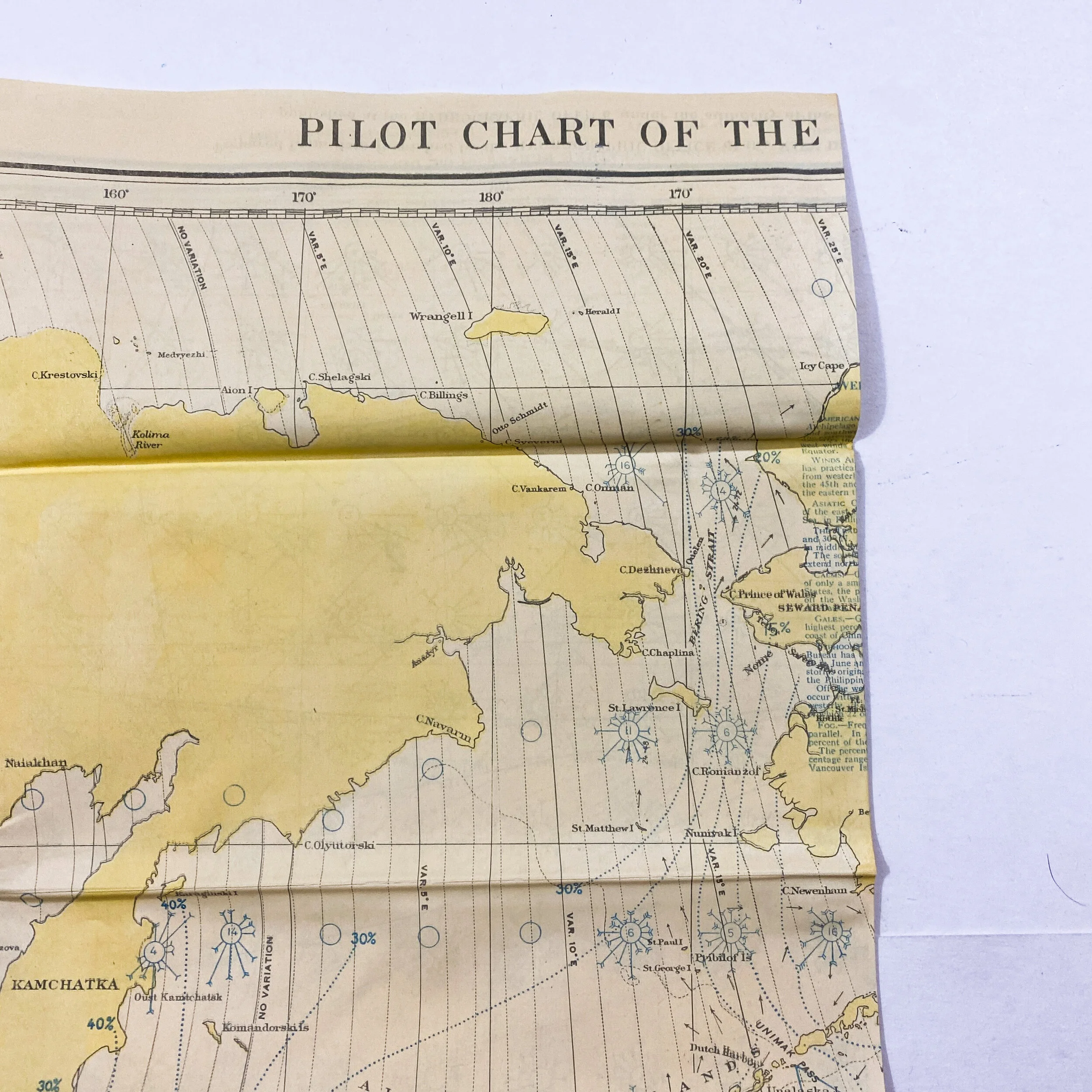


March 1944 - (A.A.F.) U.S. Army Air Force Life Raft Current Map - North Pacific Ocean - Limited Print Edition
* This map is so fragile that is cannot be fully unfolded, thus showing only half the map. Please use extreme care upon handling this item.
Size: 19 x 24.5 inches
Serial No. 1401-W
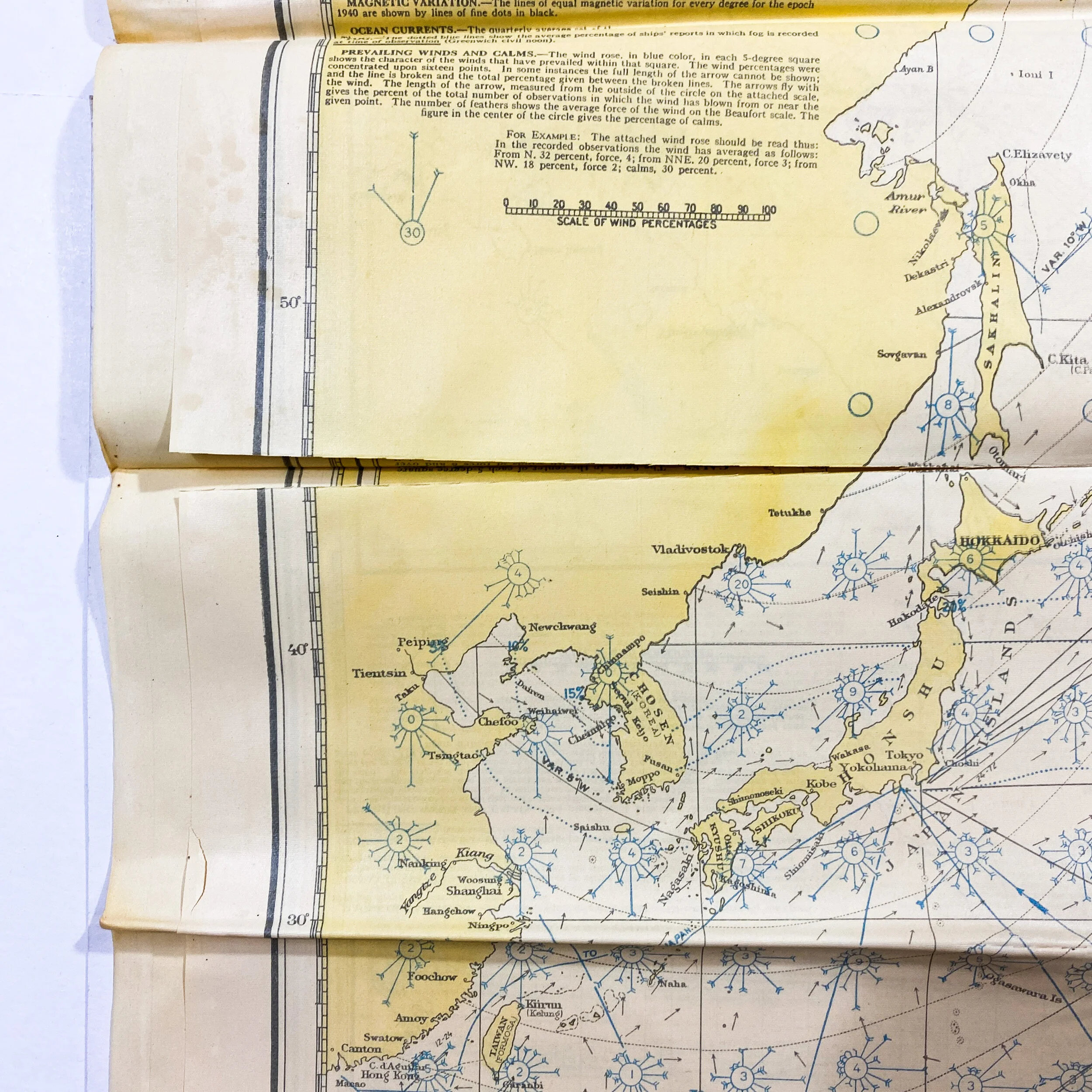
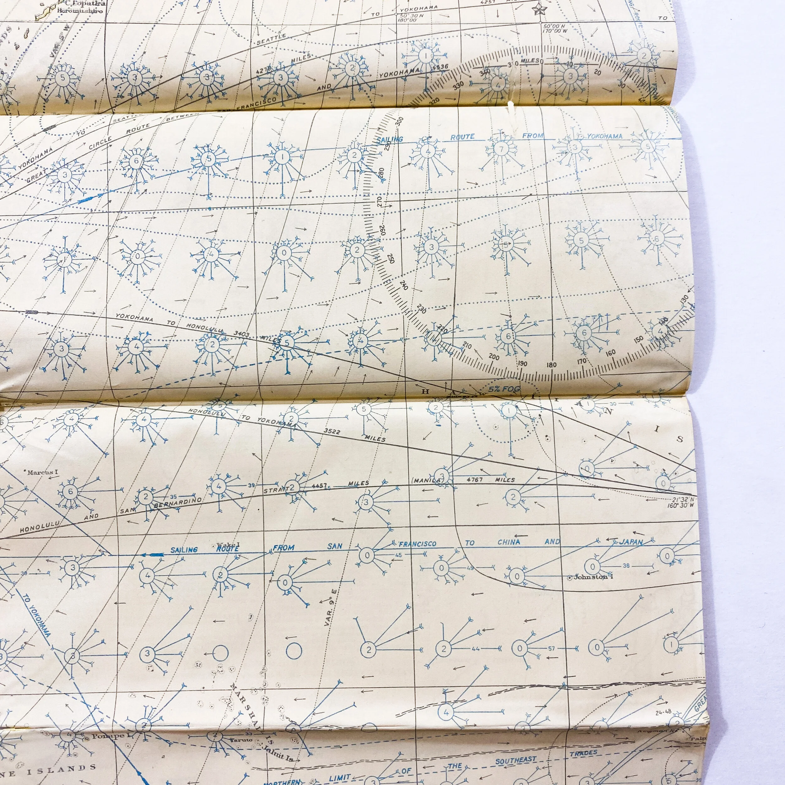
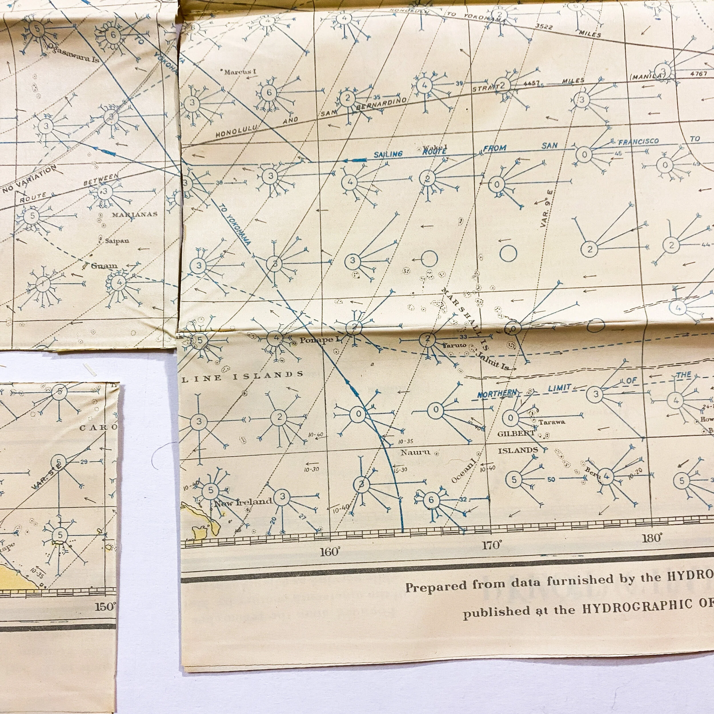
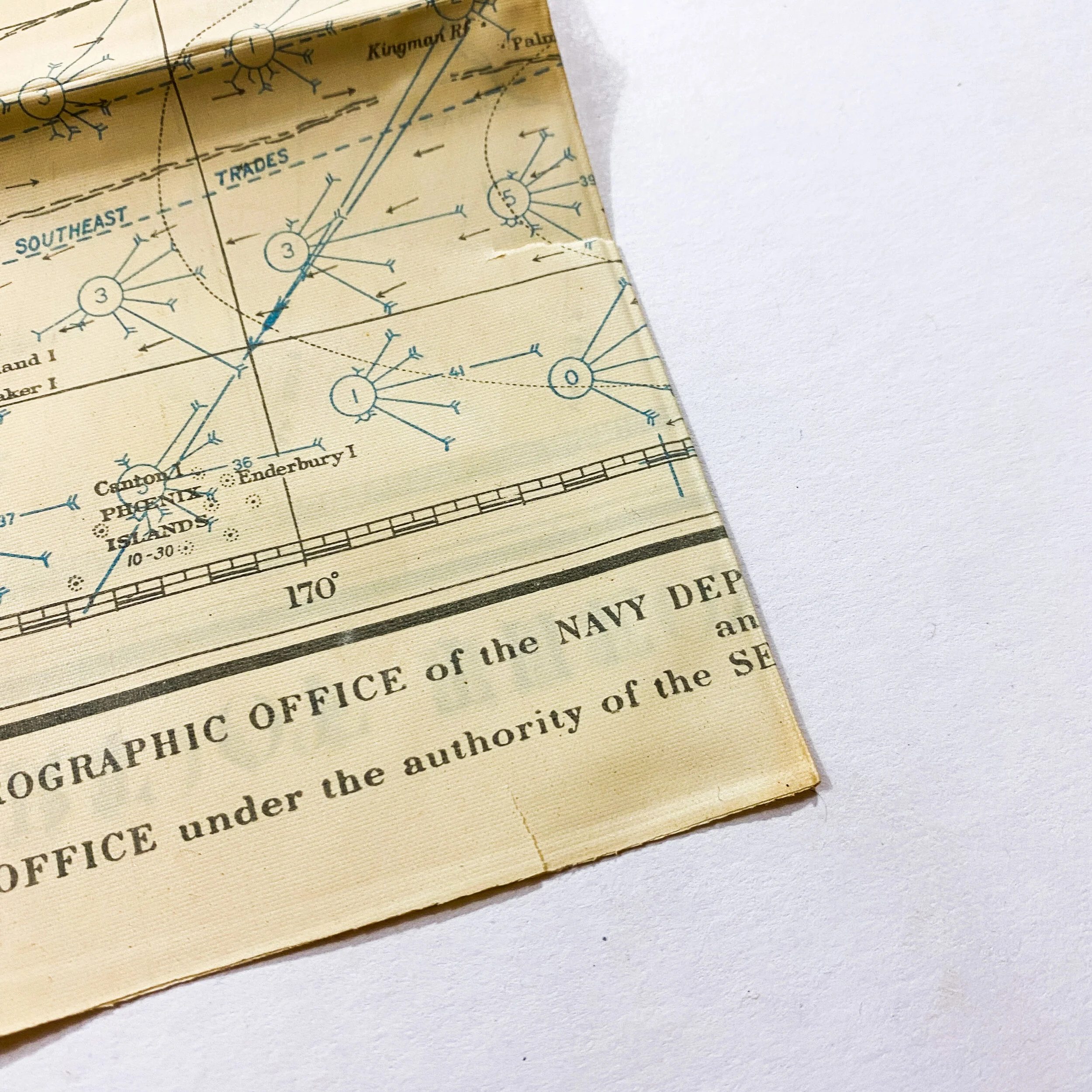
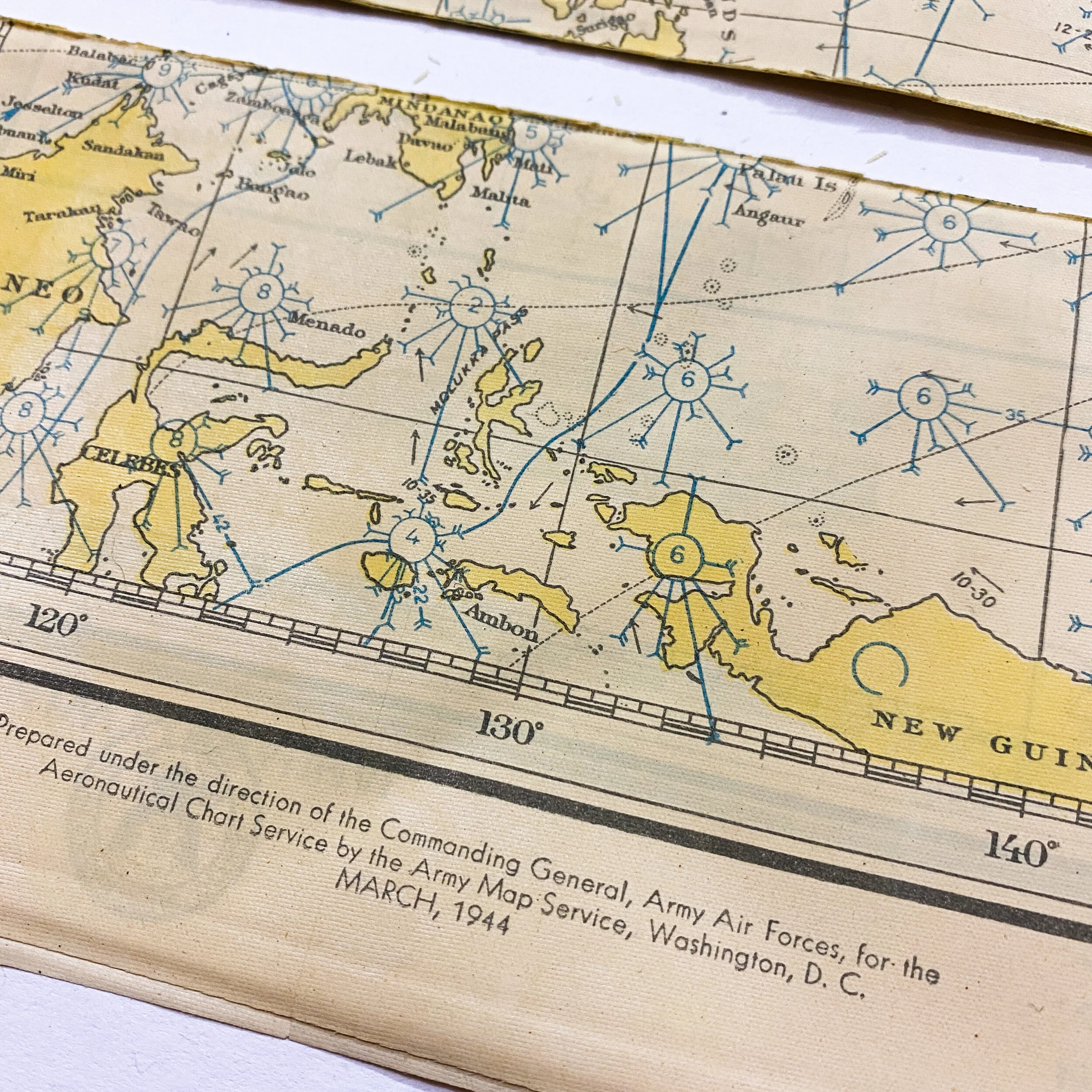
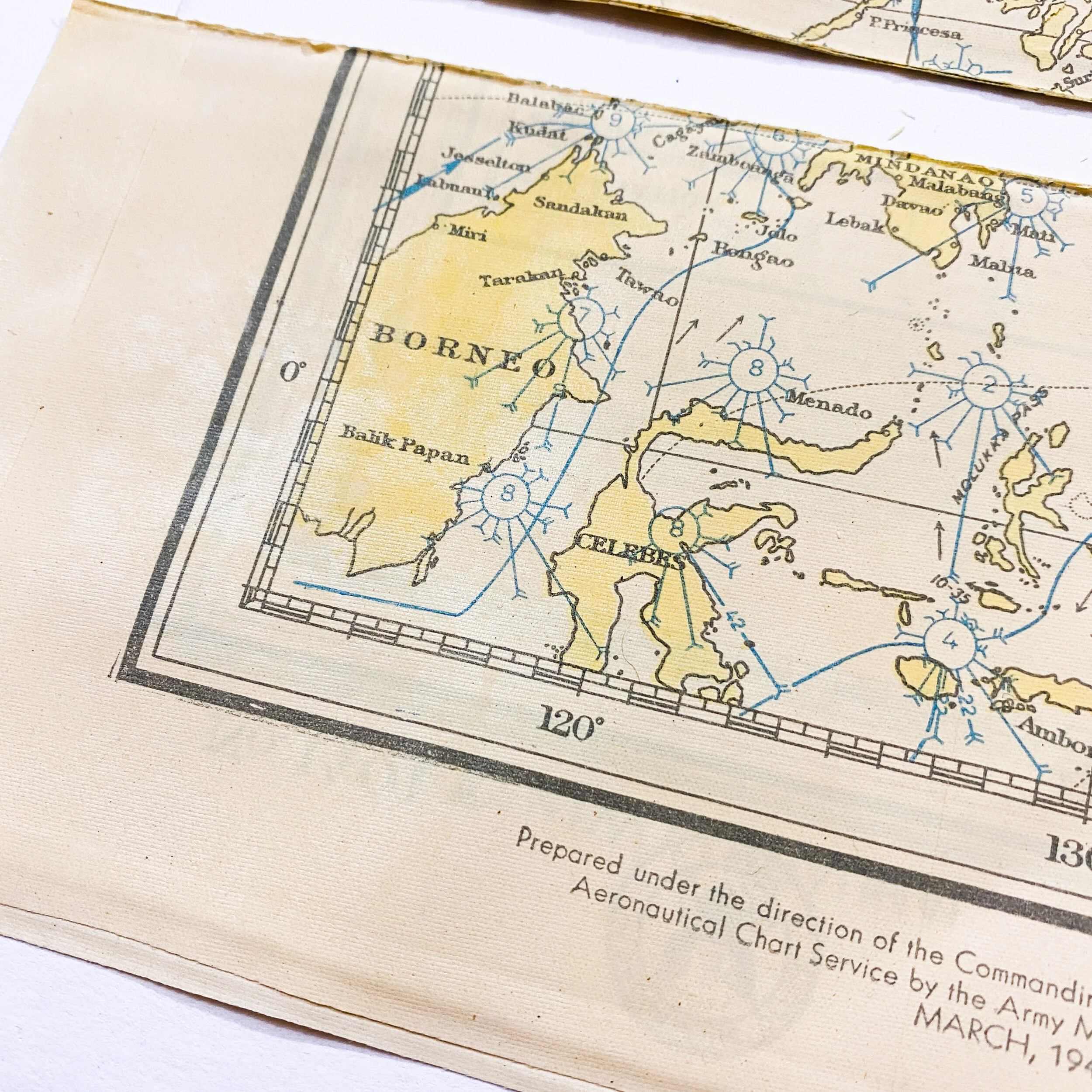
Title: South North Pacific Ocean (Summer) & North Pacific Ocean (Winter)
Pacific Theater Operations
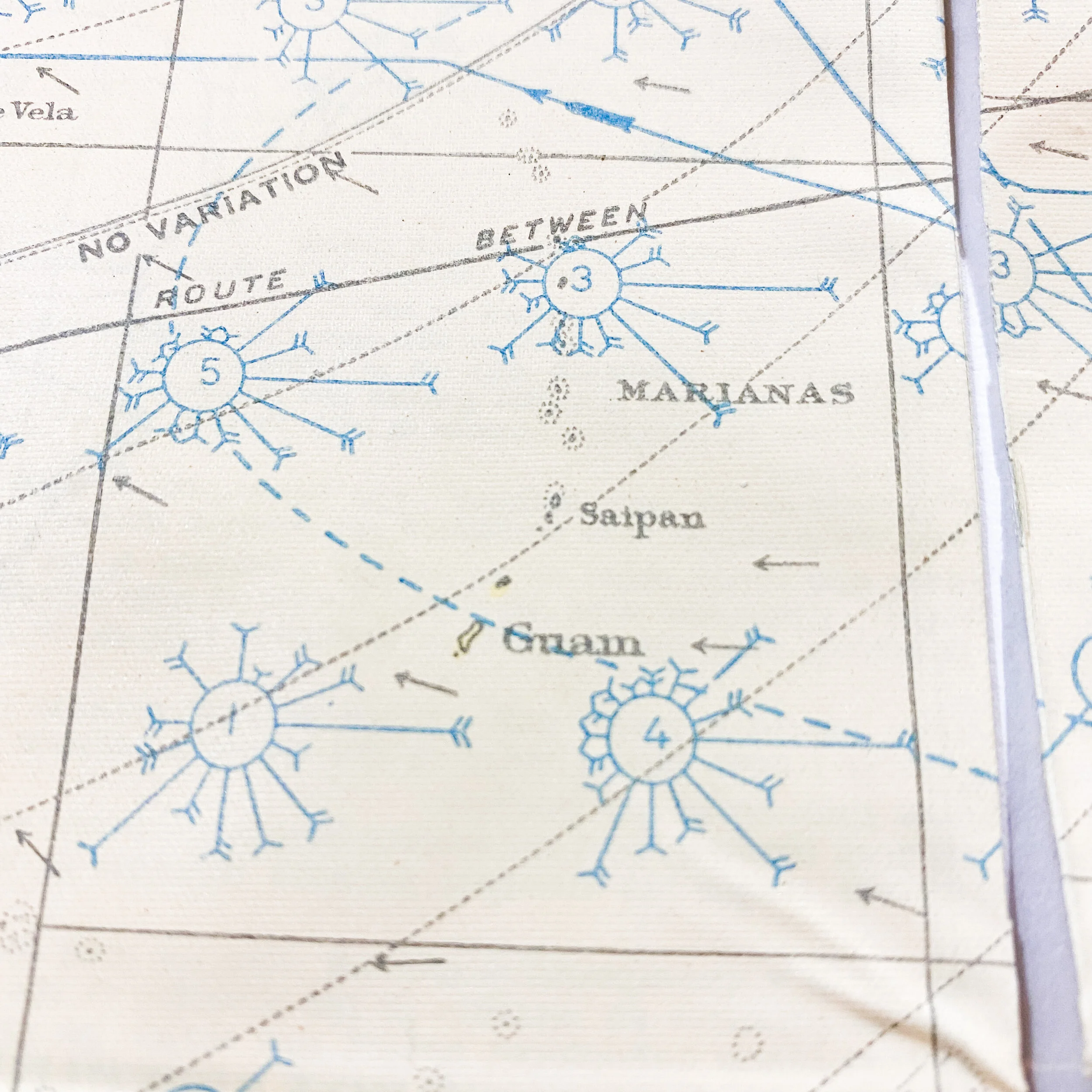
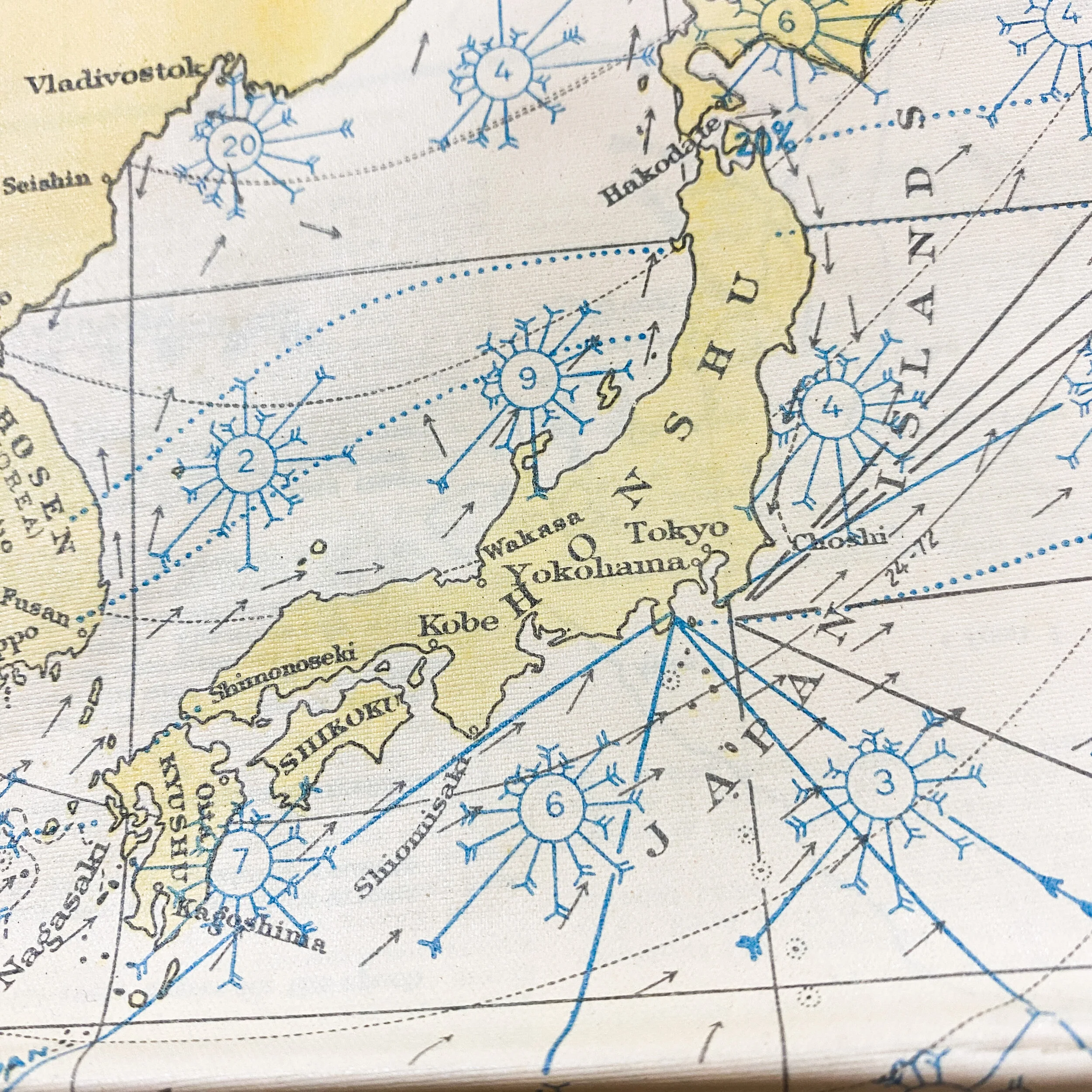
*Shows the islands of New Guinea, Celebes, Borneo, Guam, Saipan, Luzon, Okinawa, Iwo Jima, Mainland Japan, etc.
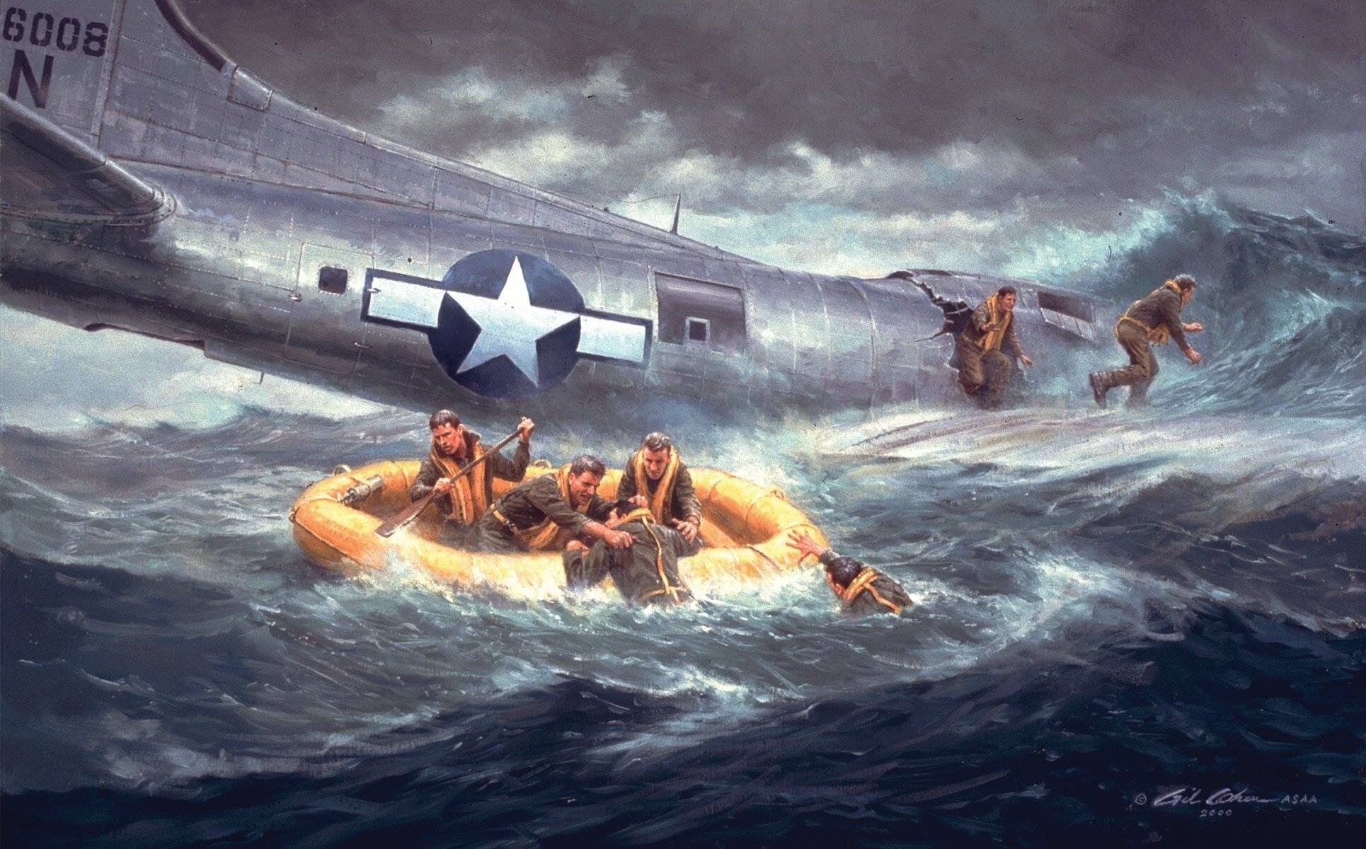
Dated 1944, this WWII (A.A.F) U.S. Army Air Force oiled pilot life raft chart map was prepared under the direction of the Commanding General, Army Air Forces, for the aeronautical chart service by the Army Map Service. Before the production of the NACI-HO rayon acetate maps and charts began, the US Navy produced US Navy Hydrographic Office Pilot Charts on oil cloth of the Atlantic and Pacific Oceans for use in the navigation of lifeboats and rafts by survivors of downed aircraft (pilots and crew) as well as torpedoed ships. These maps were created and printed on a special material that would withstand the harsh conditions of salt water and sunlight. The Hydrographic designed five special paper Pilot Charts of the North Atlantic, South Atlantic, North Pacific, South Pacific, and Indian Ocean, one side of each chart was for the summer months and the other side for the winter months. This eliminated the need for the periodic replacement of the charts and allowed for them to be permanently placed in metal containers in lifeboats. In January 1944 (2 months before this map was printed), the Hydrographic Office began selling these charts at 5 cents per chart to lifeboat manufactures for installation in their lifeboats.
“Research for a suitable material led to the enclosed impregnated fabric which appears to be ideal for the purpose. It is water-proof, non-crushable, unaffected by salt water and sunlight, folds compactly and may be quickly smoothed out for use....This chart should also prove valuable as a means of catching rainwater, as an auxiliary sail, as a covering to protect the body from the sun, rain, and spray. Further, with the land areas printed in bright yellow ink, it would serve as a signal to searching ships and planes.”
The A.M.S. procured a total of 139,000 five-chart packages, with the orders in March 1944 (78,000 packages), July 1944 (26,000 packages), September 1944 (21,000 packages), and February 1945 (34,000 packages) placed with the William Kuhlman and Company to satisfy both AAF and subsequent Navy requirements. Like the four-chart packs, the color of land on the charts for AAF is bright yellow, with water a faded yellow, base features in black, and nautical information in blue.
The information and changes regarding the ocean currents were crucial for pilots and down crews to survive the treacherous ocean and navigate towards land masses nearby. While having this map did not guarantee safety, it provided hope for many pilots and downed crew members stranded in the ocean and in enemy waters.
*Please note this map is extremely delicate because of the “special oiled material” this map is printed on. Extreme precautions will be take to package the map, however, upon receiving the map we suggest immediately framing the map behind glass to prevent further damage.