WWII 1945 LORAN US Navy Air Navigation Map New Guinea -Saipan - Guam - Guadalcanal


WWII 1945 LORAN US Navy Air Navigation Map New Guinea -Saipan - Guam - Guadalcanal
Comes with hand-signed C.O.A.
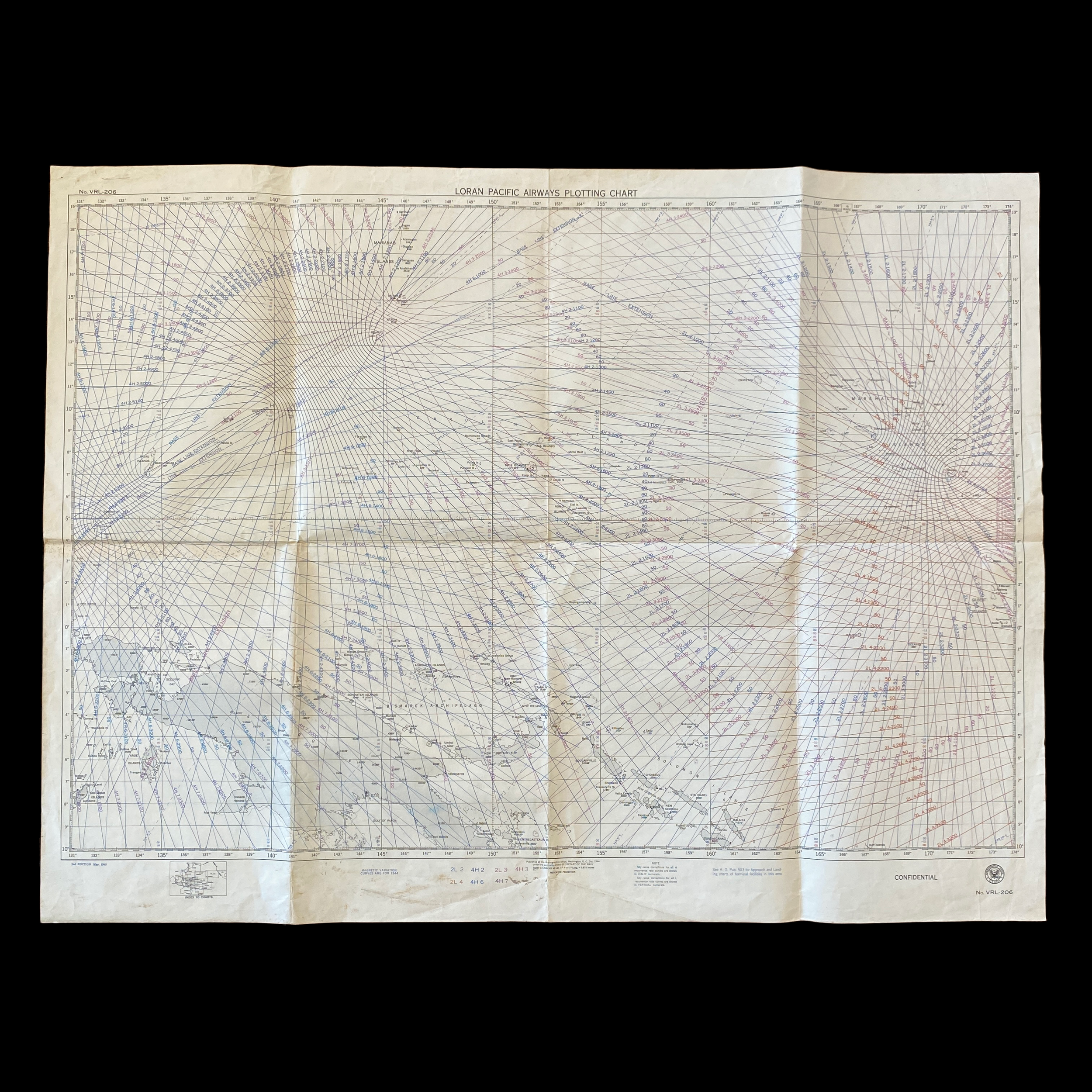
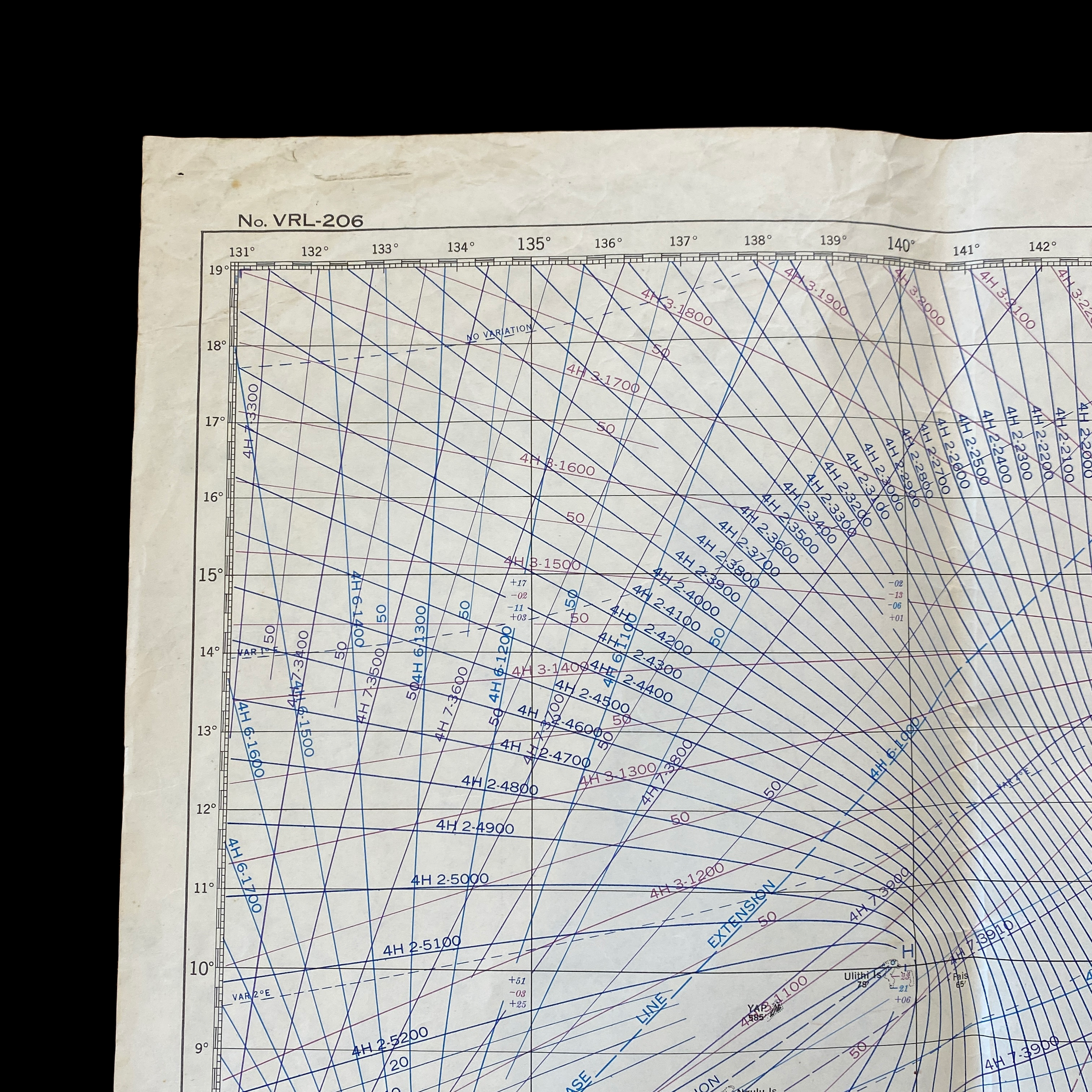
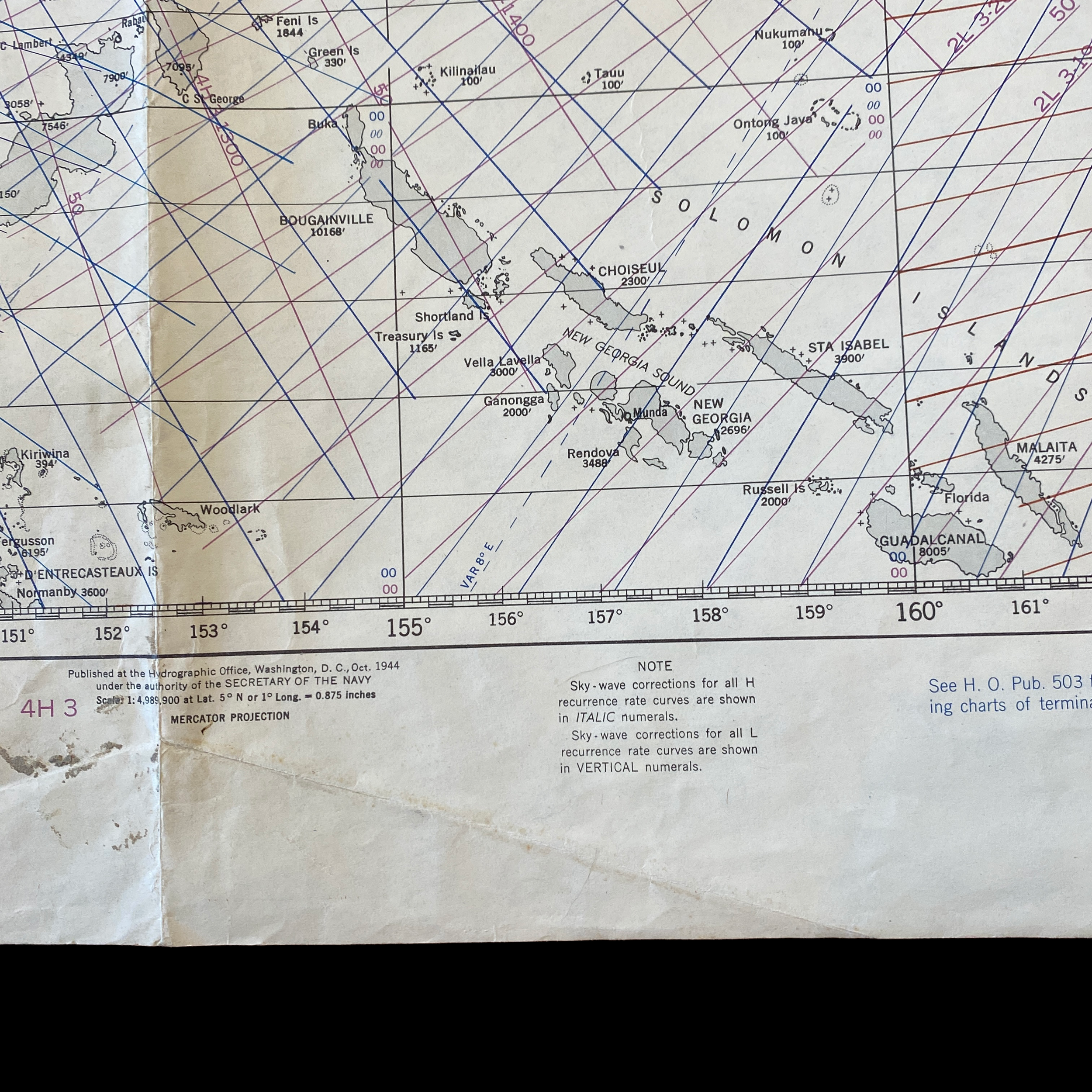
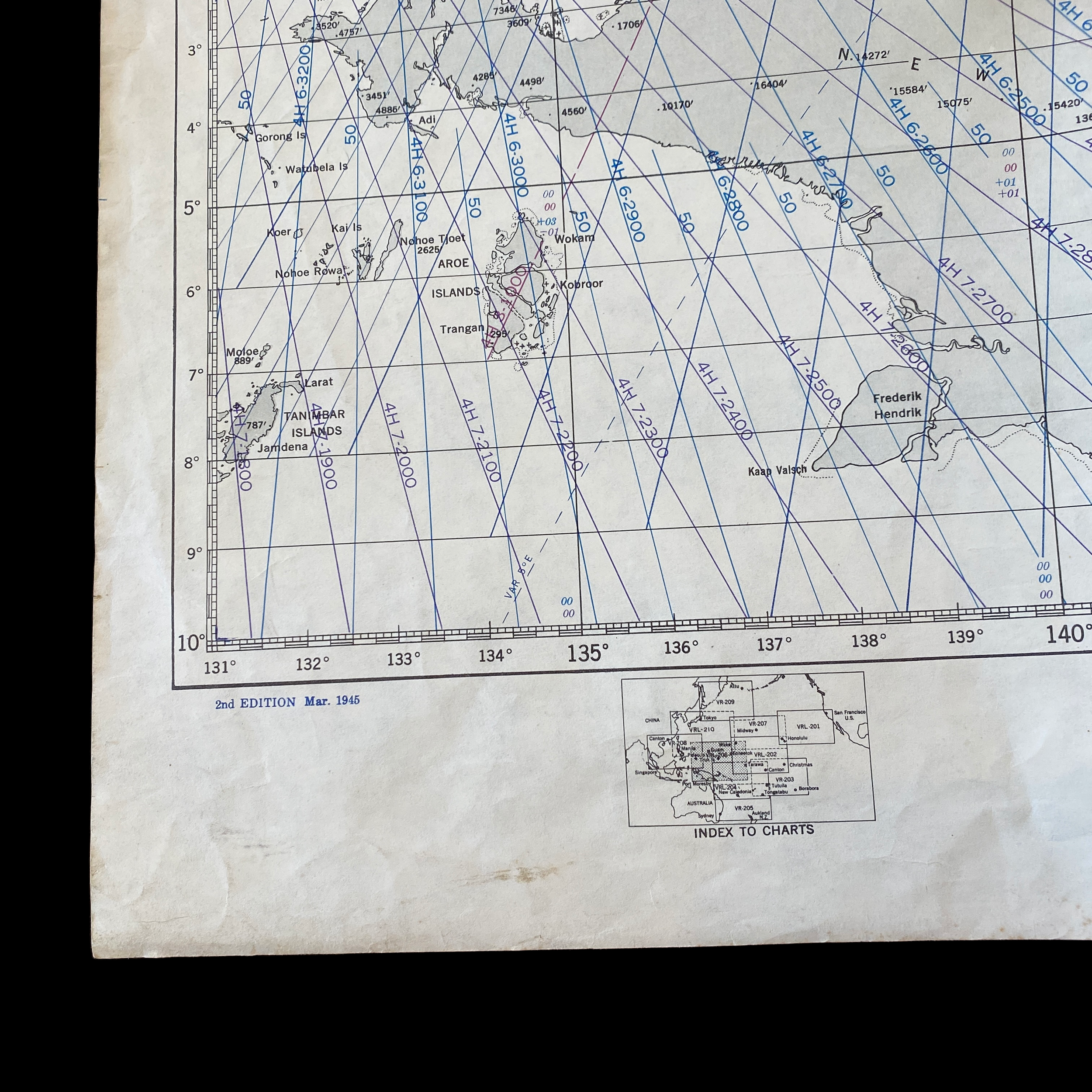
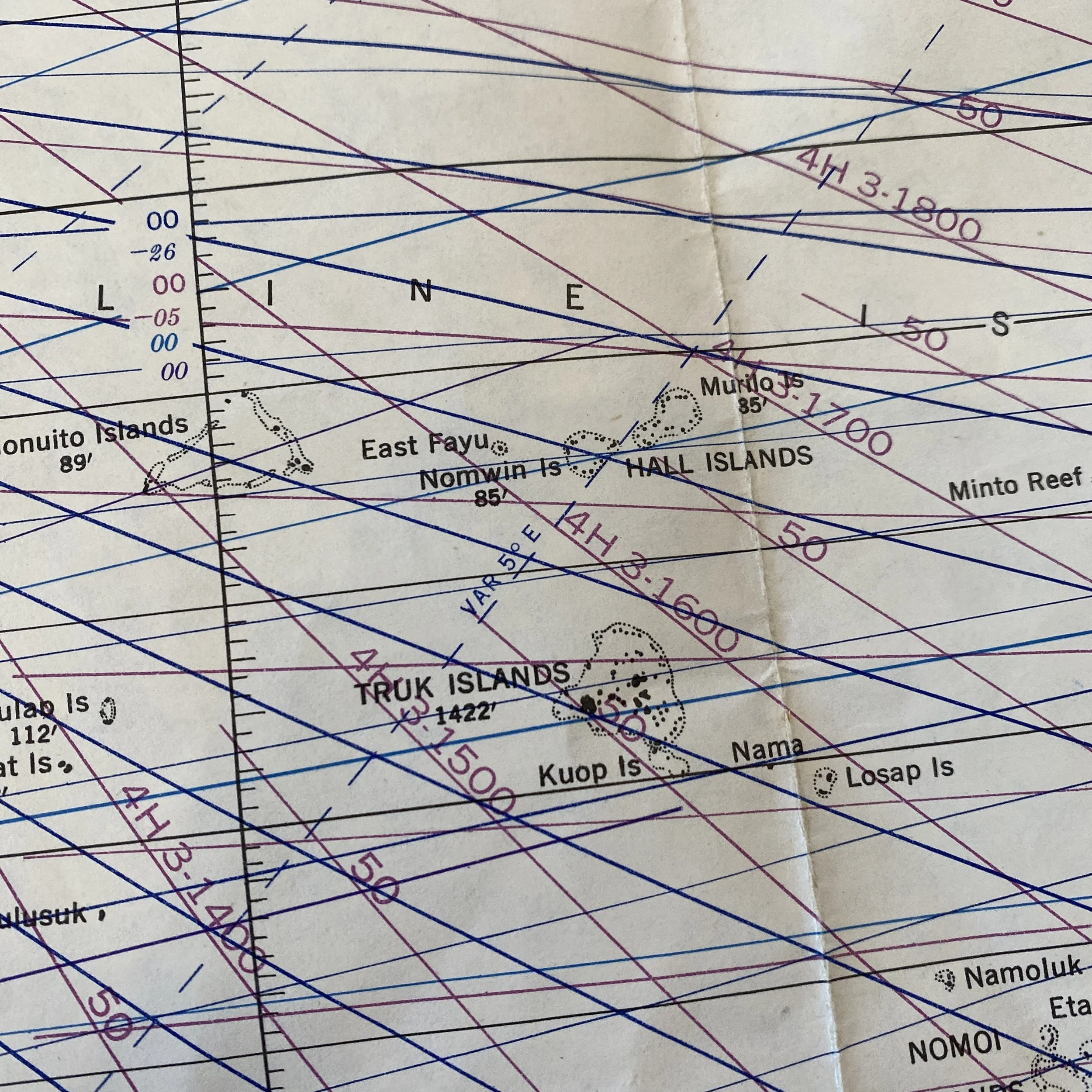
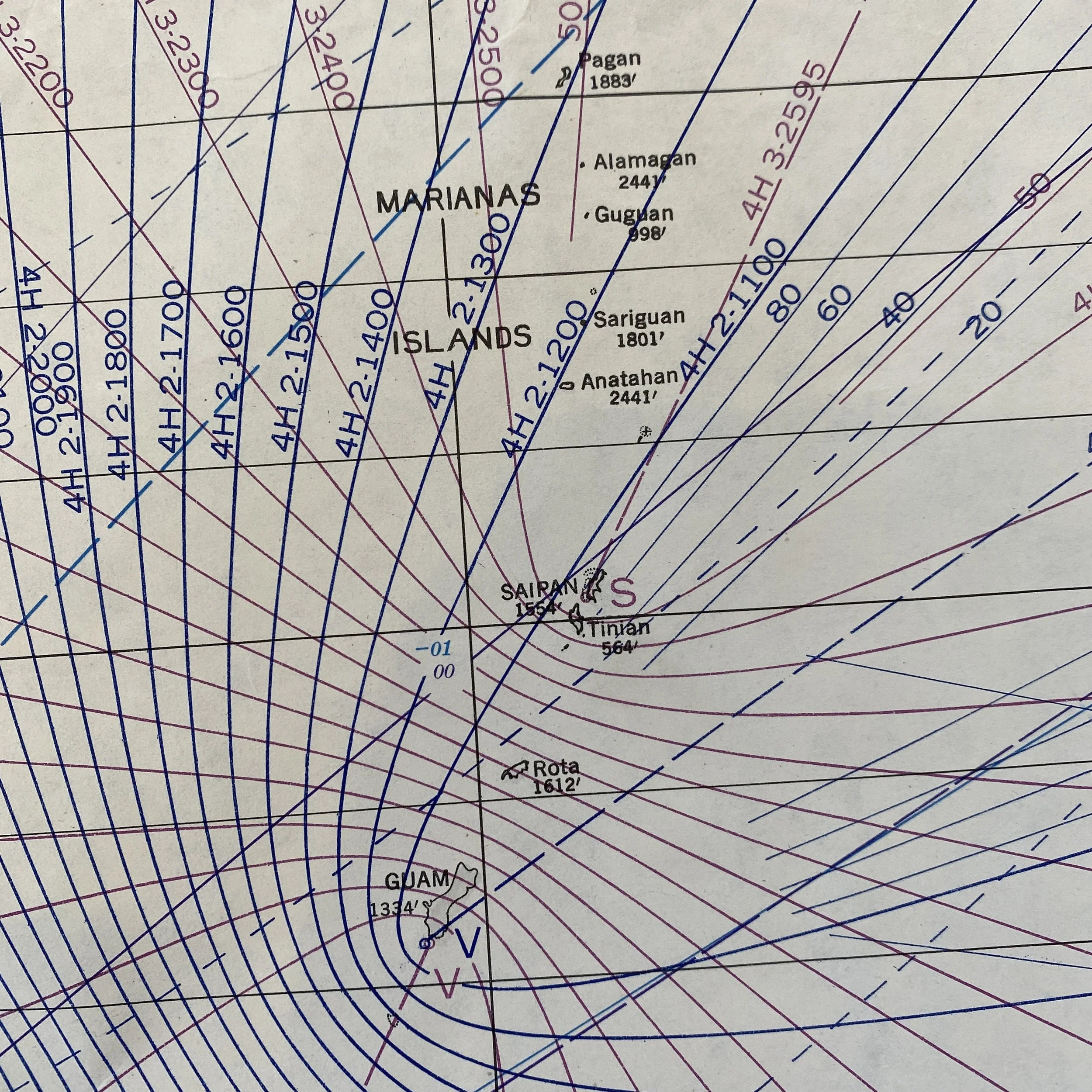
This incredibly rare and museum grade World War II US naval map is a very rare and scarcely printed “LORAN PACIFIC AIRWAYS PLOTTING CHART”. Dated 1945 this Pacific Theater plotting chart shows the islands of New Guinea, Solomon Islands, Palau Islands, Saipan, Guam, Marianas Islands, Tinian, Gilbert Islands, and Guadalcanal.
LORAN, short for long range navigation, was a hyperbolic radio navigation system developed in the United States during World War II. It was similar to the UK's Gee system but operated at lower frequencies in order to provide an improved range up to 1,500 miles (2,400 km) with an accuracy of tens of miles. It was first used for ship convoys crossing the Atlantic Ocean, and then by long-range patrol aircraft, but found its main use on the ships and aircraft operating in the Pacific theater during World War II.
This chart shows great theater use for its age and would make an amazing addition to any WWII collection.