WWII 90th Bomb Group Jolly Rodger B-24 Range Navigator Arabian Sea Map


WWII 90th Bomb Group Jolly Rodger B-24 Range Navigator Arabian Sea Map
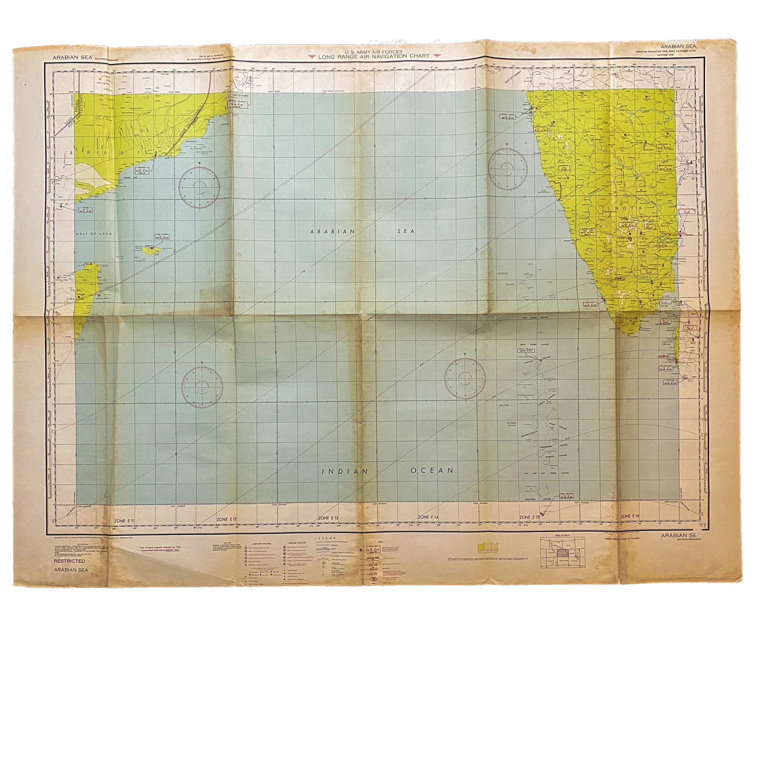
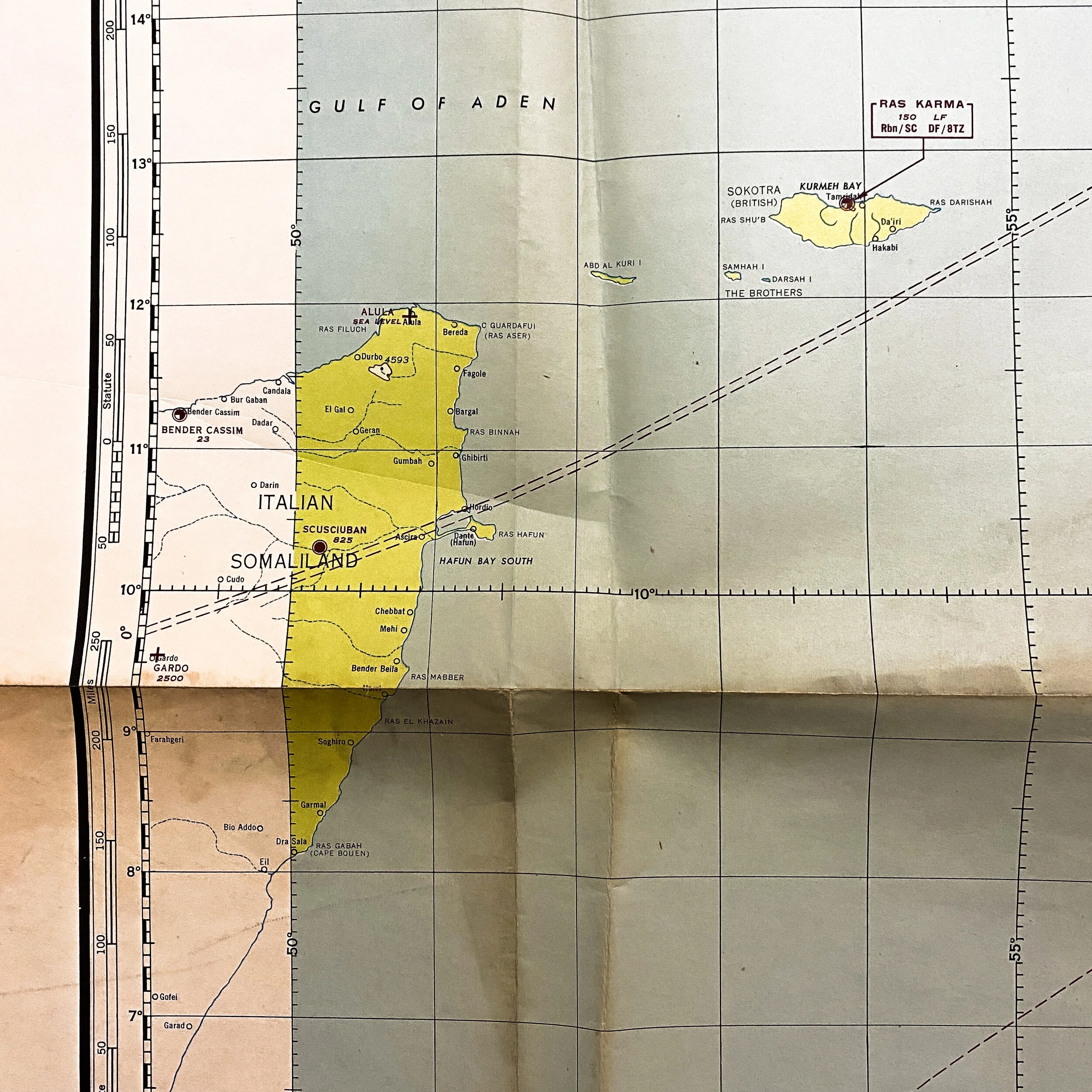
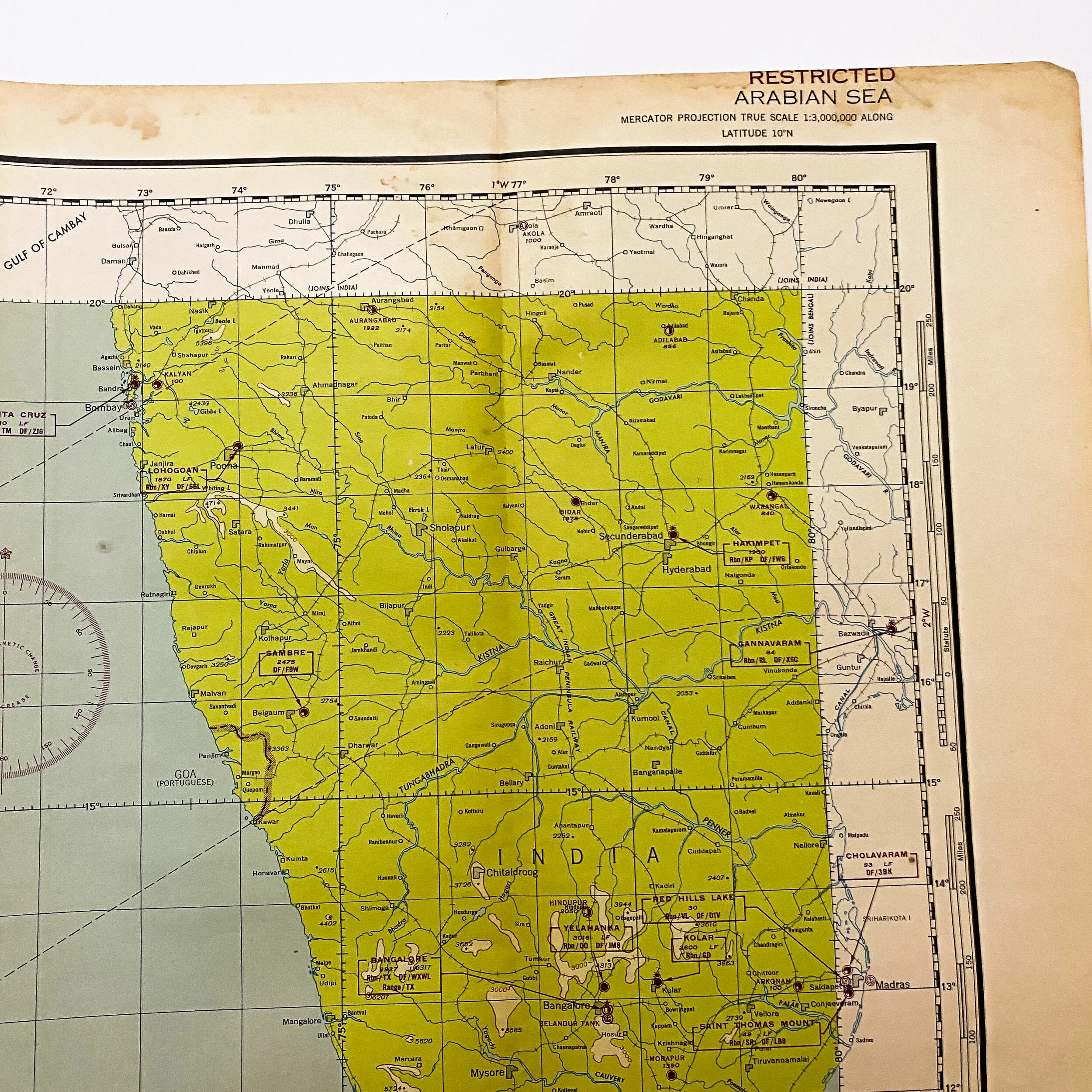
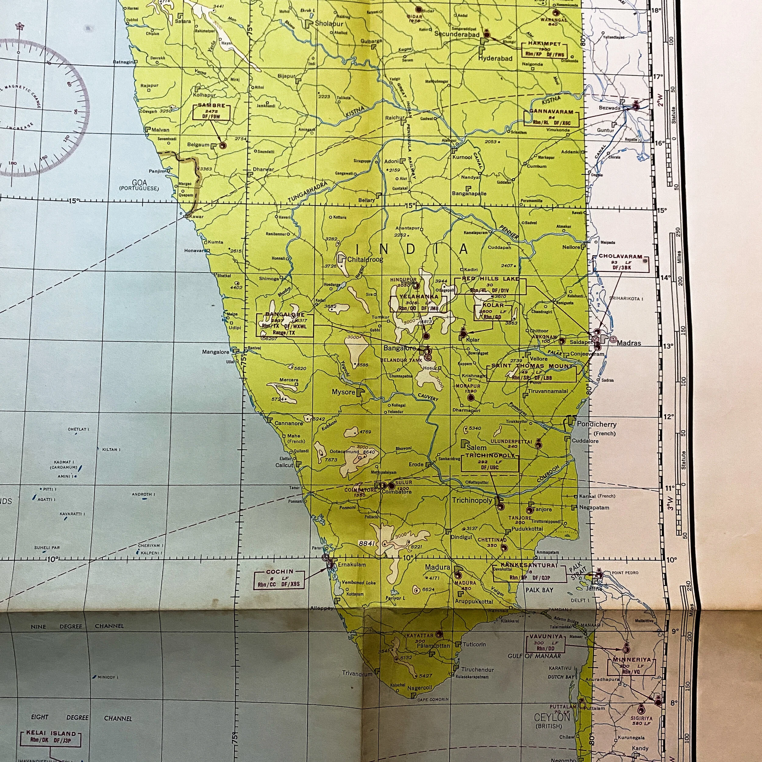
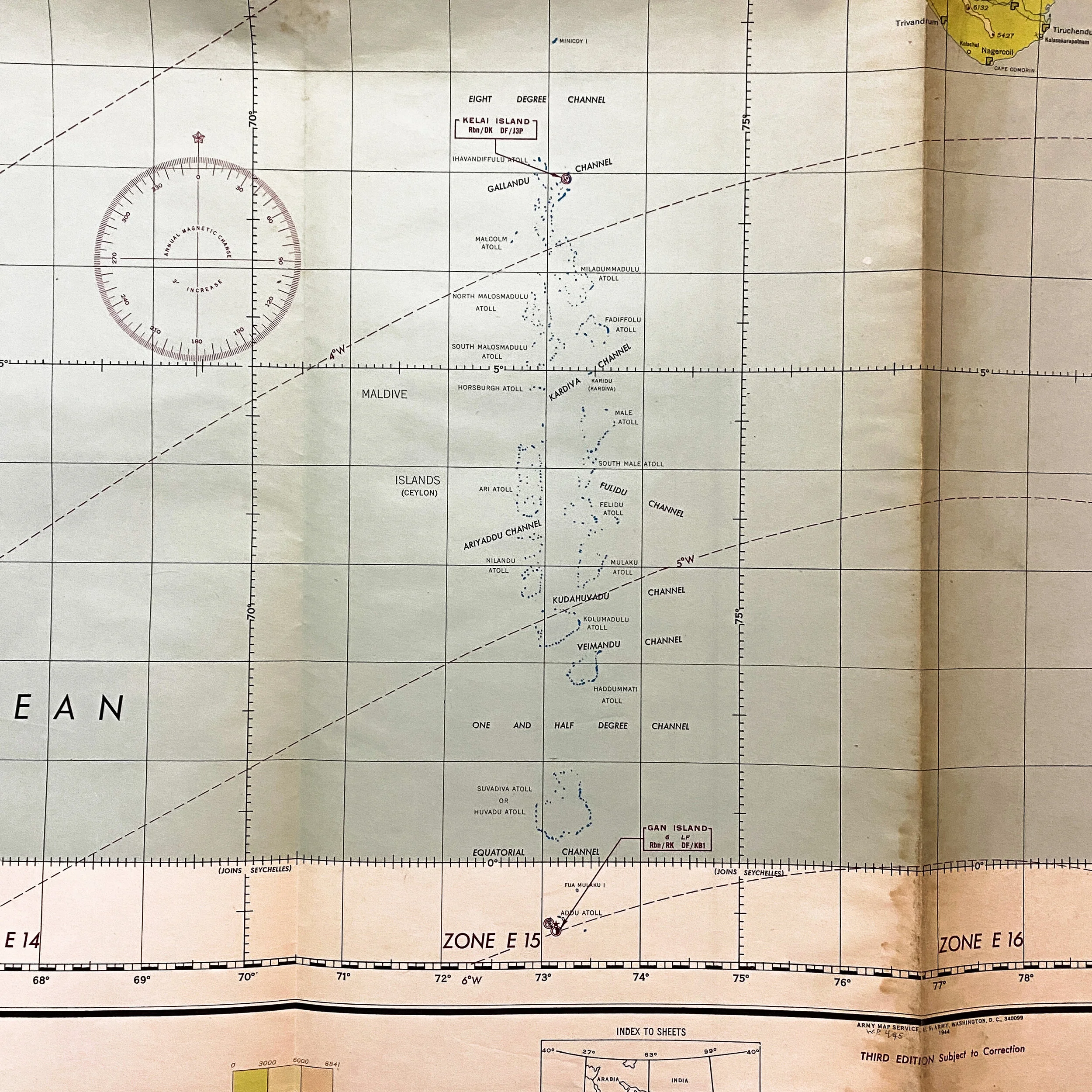
This is an extremely rare marked RESTRICTED 1943 dated US Army Air Forces 'Long Range Air Navigation Chart' combat used navigation and bombardment map that was used by the navigator on a B-24M bomber during the Pacific War. These long range maps were carried by the navigator for pre-flight briefings and carried on the B-24M itself as they made their approach to the target.
This map was printed by the US war department map and measures a large 50 inches tall x 40 inches wide and in very sturdy condition. This would have been very helpful and used as a visual marker for the navigator and bombardier to better identify their approach to the target.
The Jolly Rogers -5th Air Force - 90th Bomb Group - Heavy:
Formed in early 1942, the 90th Bombardment Group, part of the Fifth Air Force of the United States Army Air forces, operated the Consolidated B-24 Liberator heavy bomber in the Southwest Pacific Theater, initially from Queensland, Australia. The group was awarded two Distinguished Unit Citations and the Philippine Presidential Unit Citation for its extensive and meritorious combat service.
The 90th Bomb Group attacked enemy airfields, troop concentrations, ground installations and shipping in New Guinea, the Bismarck Archipelago, Palau and the southern Philippines. The group was awarded a Distinguished Unit Citation for operations in Papua. During 1944, the 90th supported the New Guinea Campaign through the end of June as well as the Philippines and supported ground forces on Luzon, attacked industrial targets on Formosa, and bombed railways, airfields, and harbor facilities. Shortly before the end of the war in the Pacific, the 90th moved to Okinawa, from which it would be able to strike the Japanese home islands.