Rare 'CONFIDENTIAL' 1945 Pacific Theater - U.S. Navy LORAN (LOng RANge Navigation) Pacific Theater Map
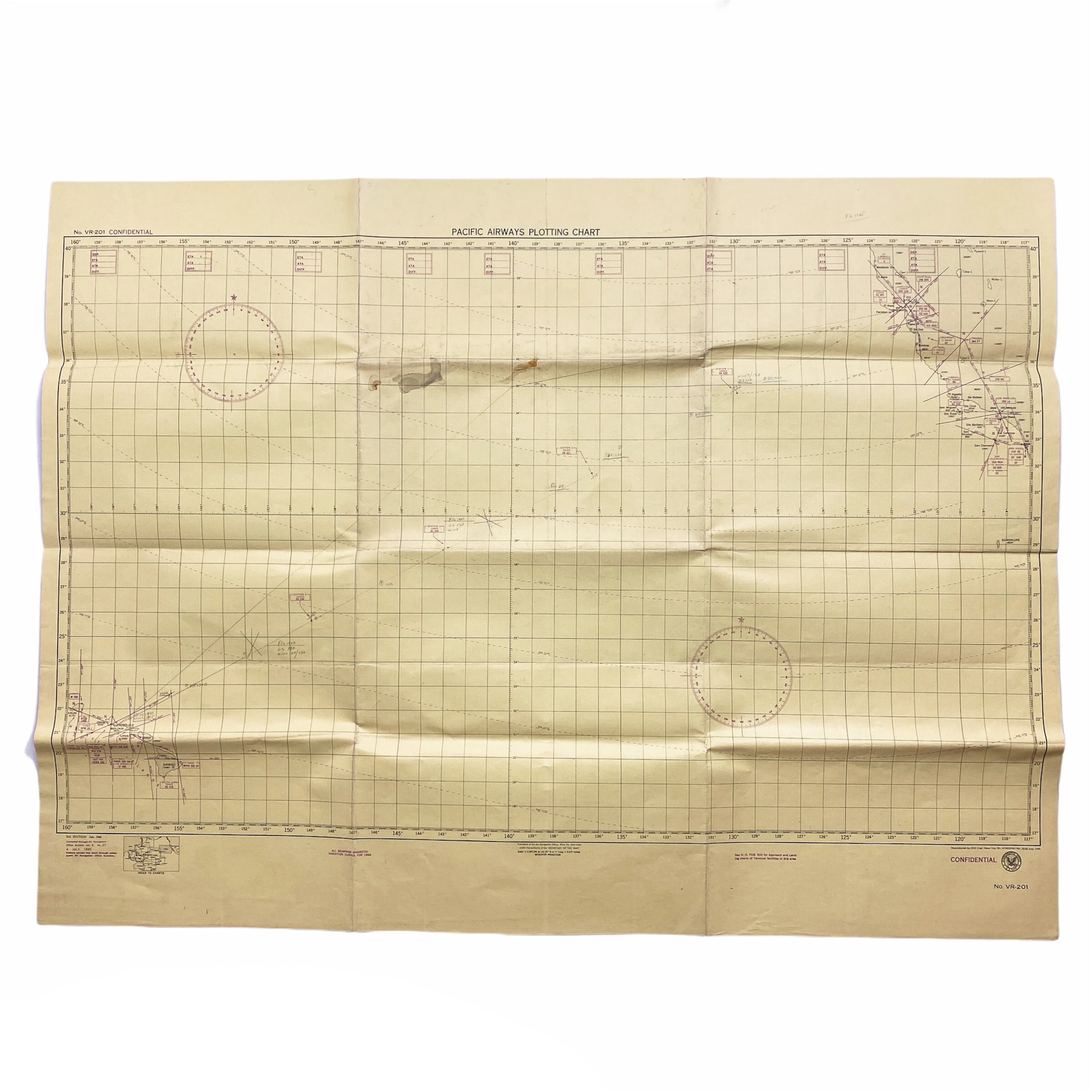
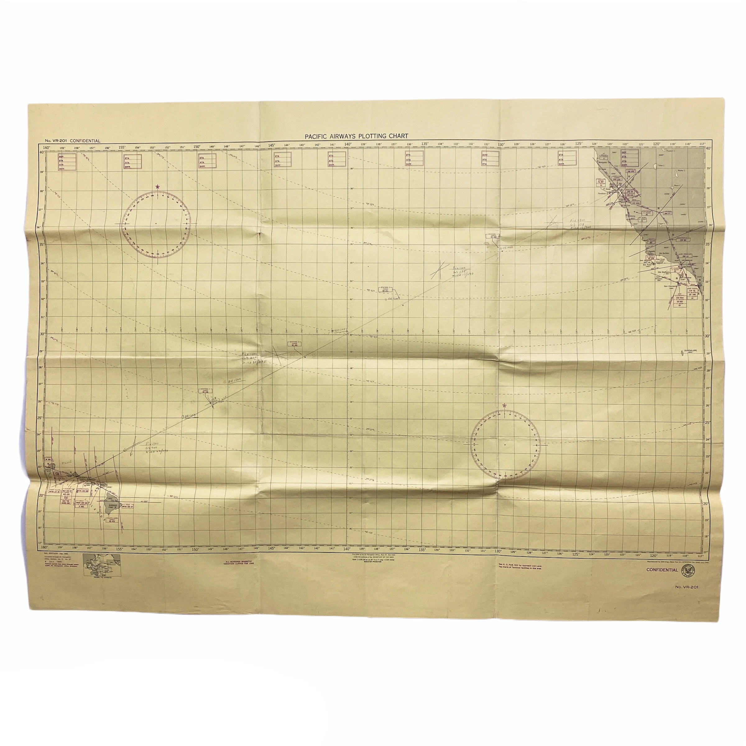


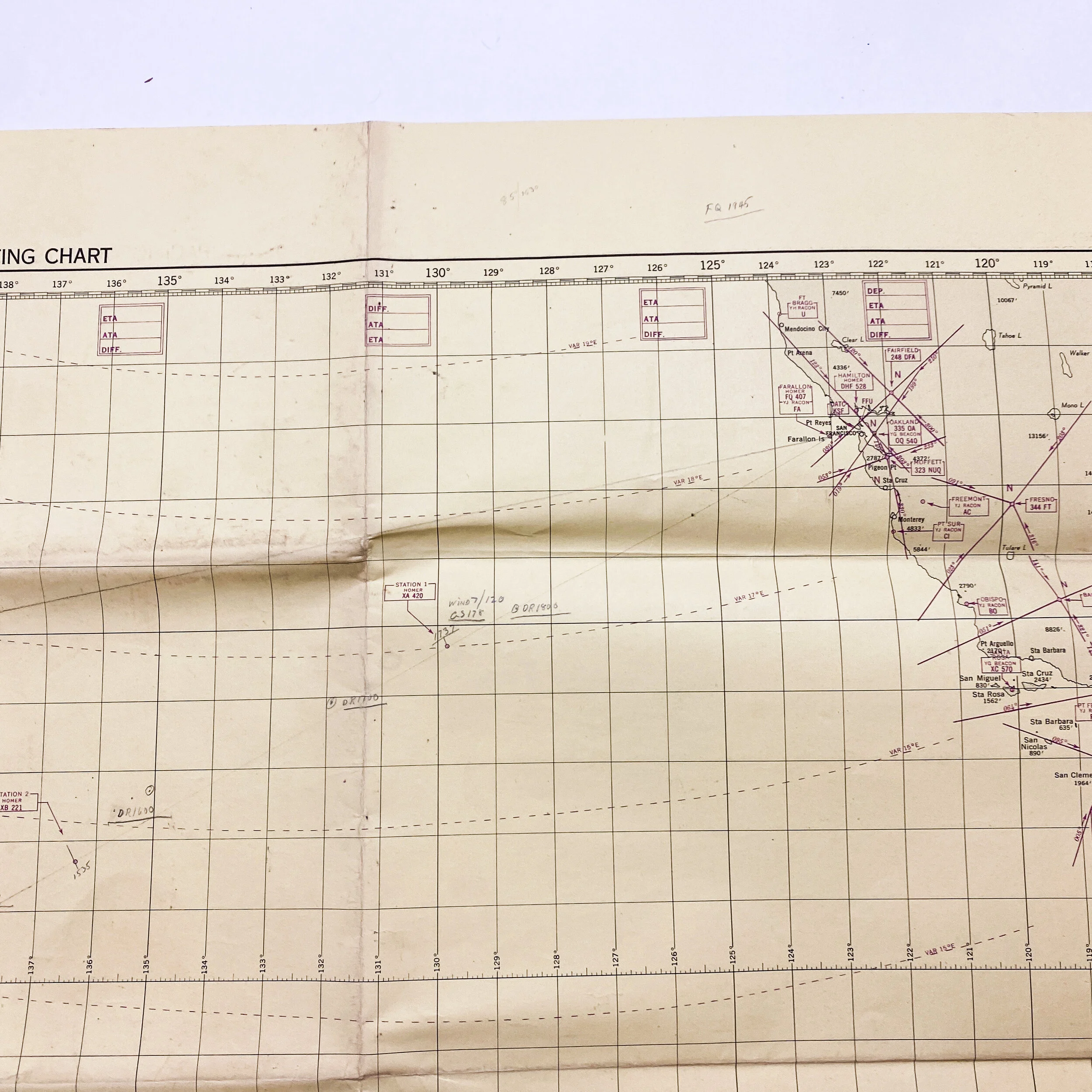
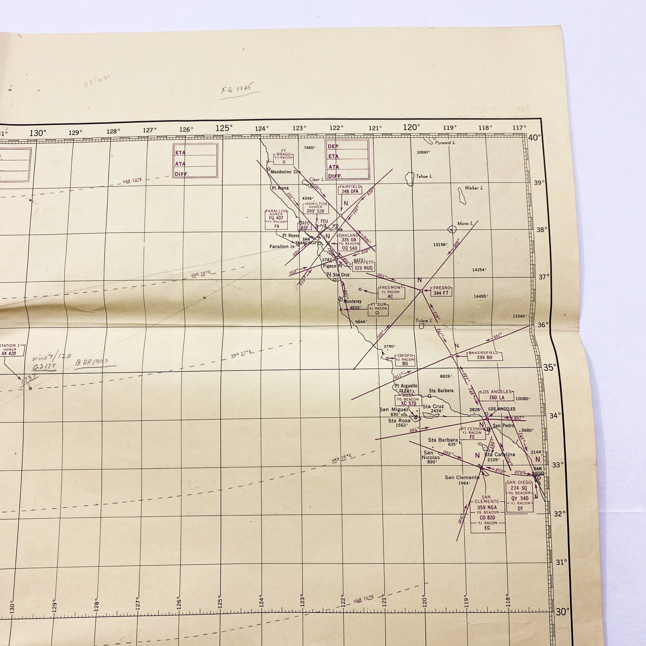
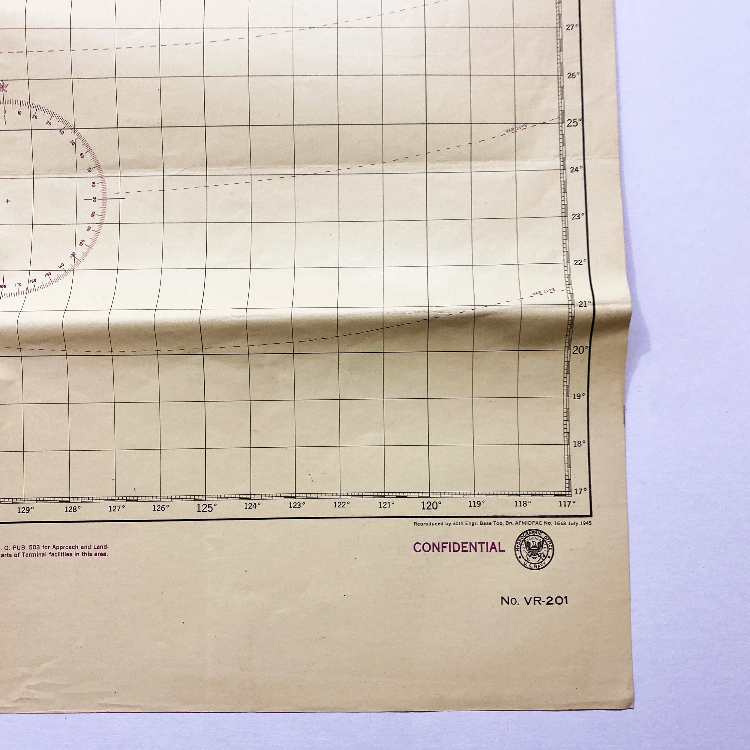
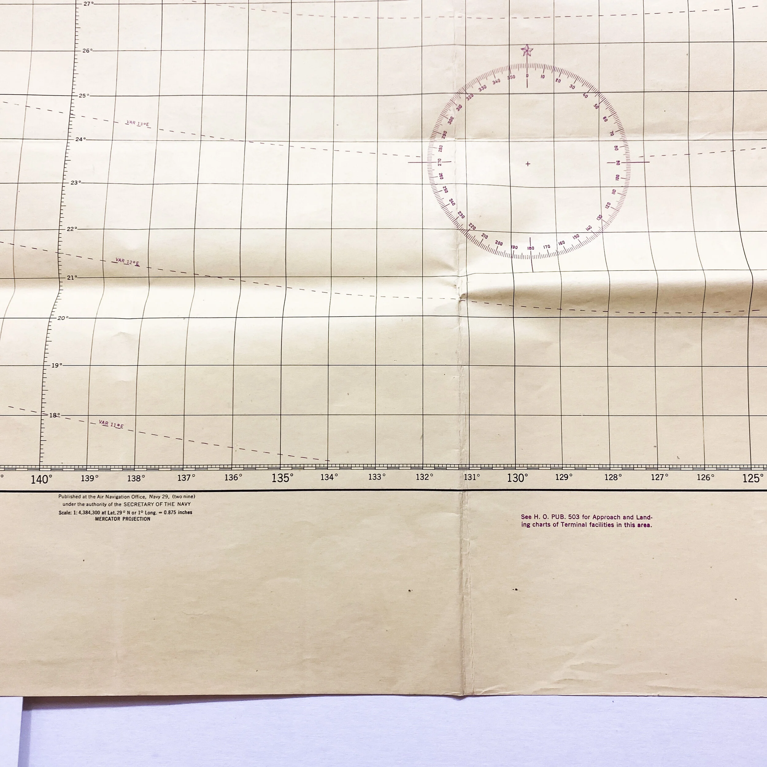

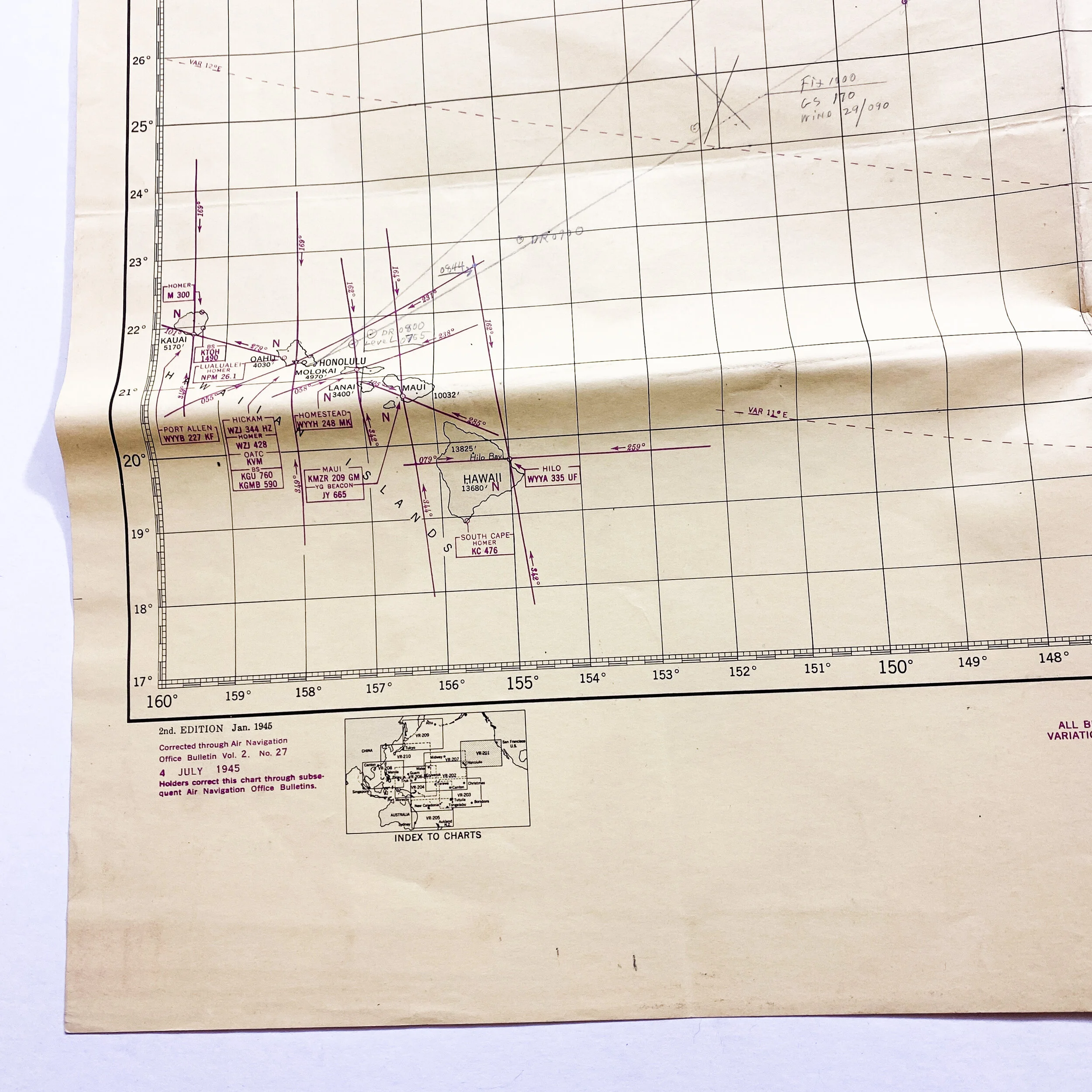


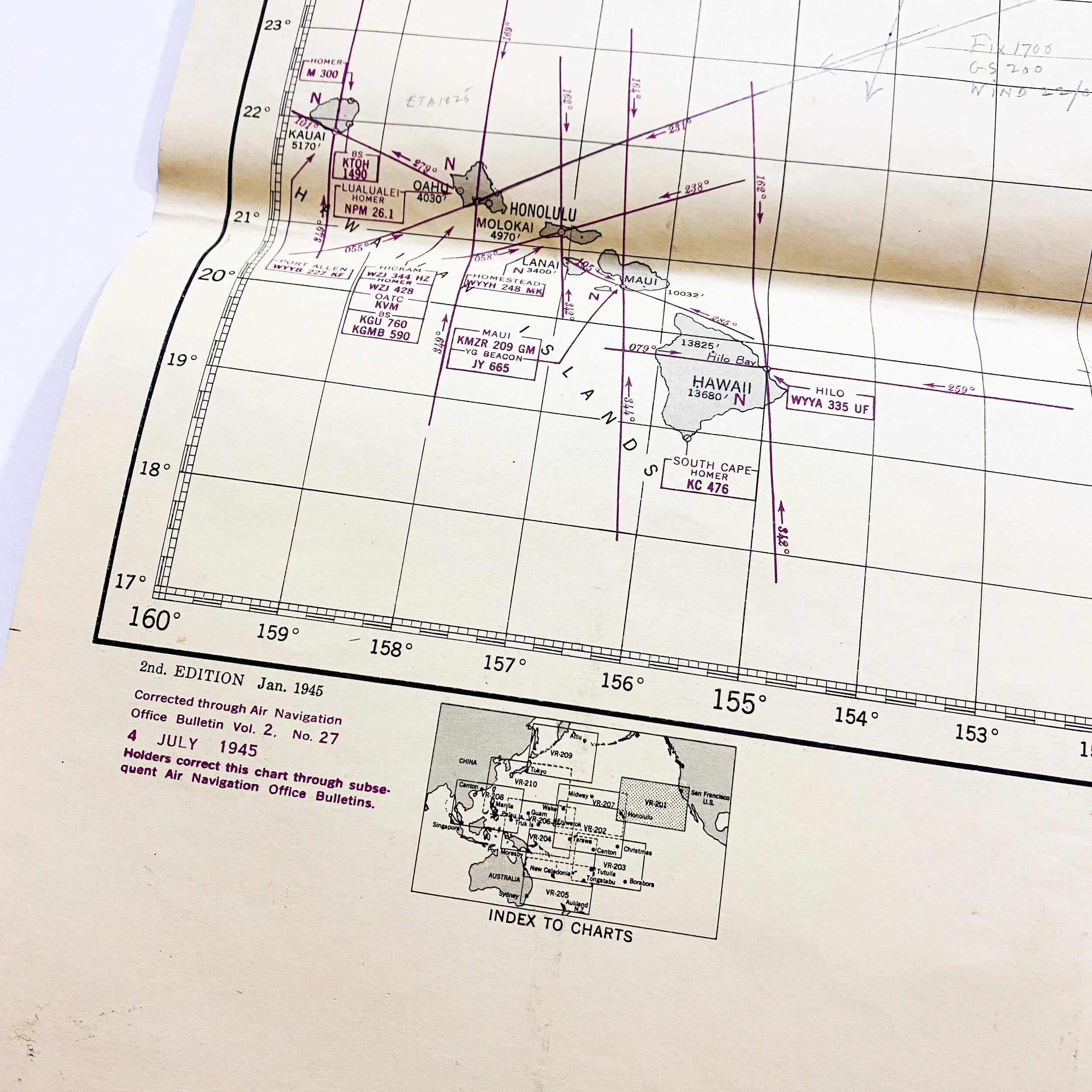


Rare 'CONFIDENTIAL' 1945 Pacific Theater - U.S. Navy LORAN (LOng RANge Navigation) Pacific Theater Map
Size: 30 x 40 inches
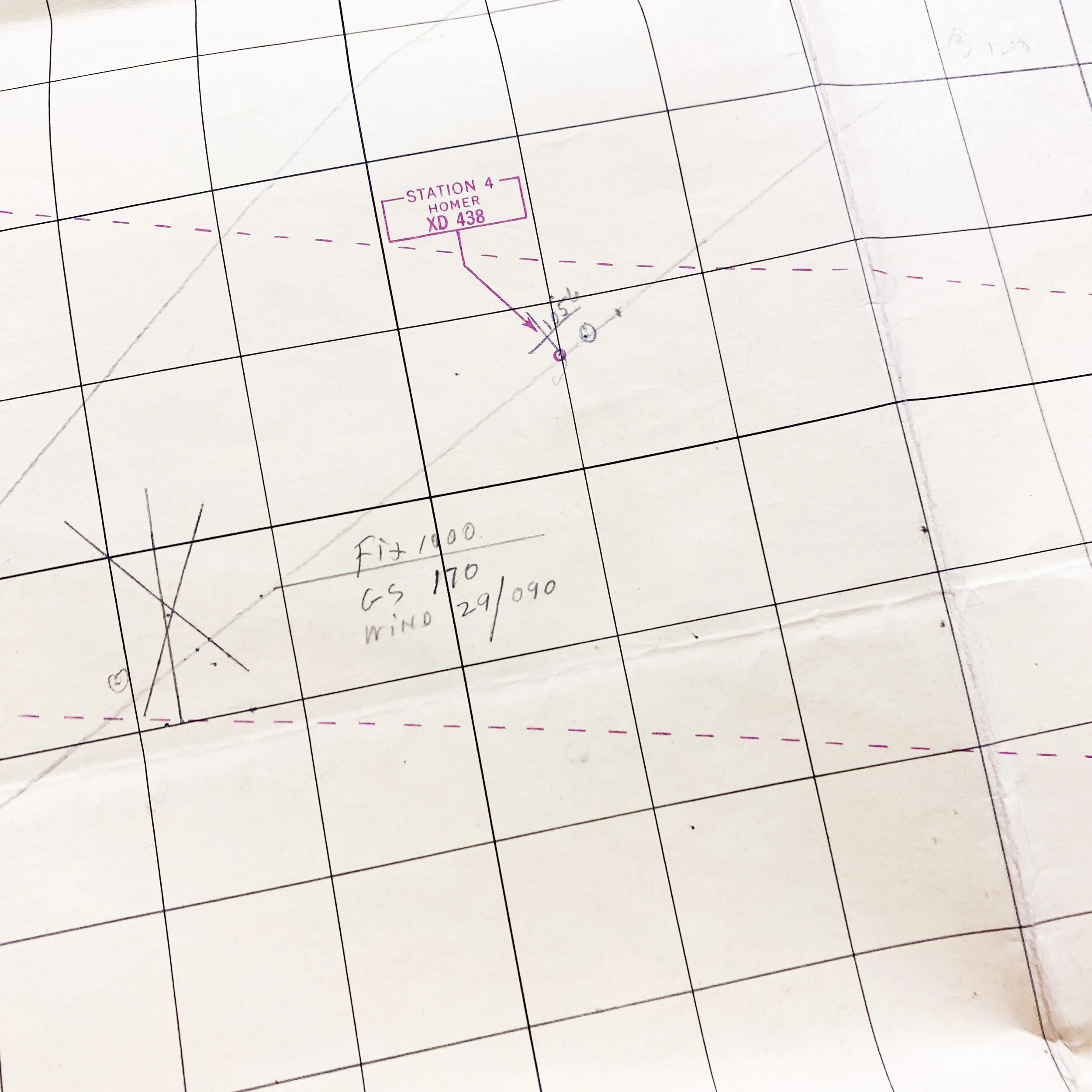
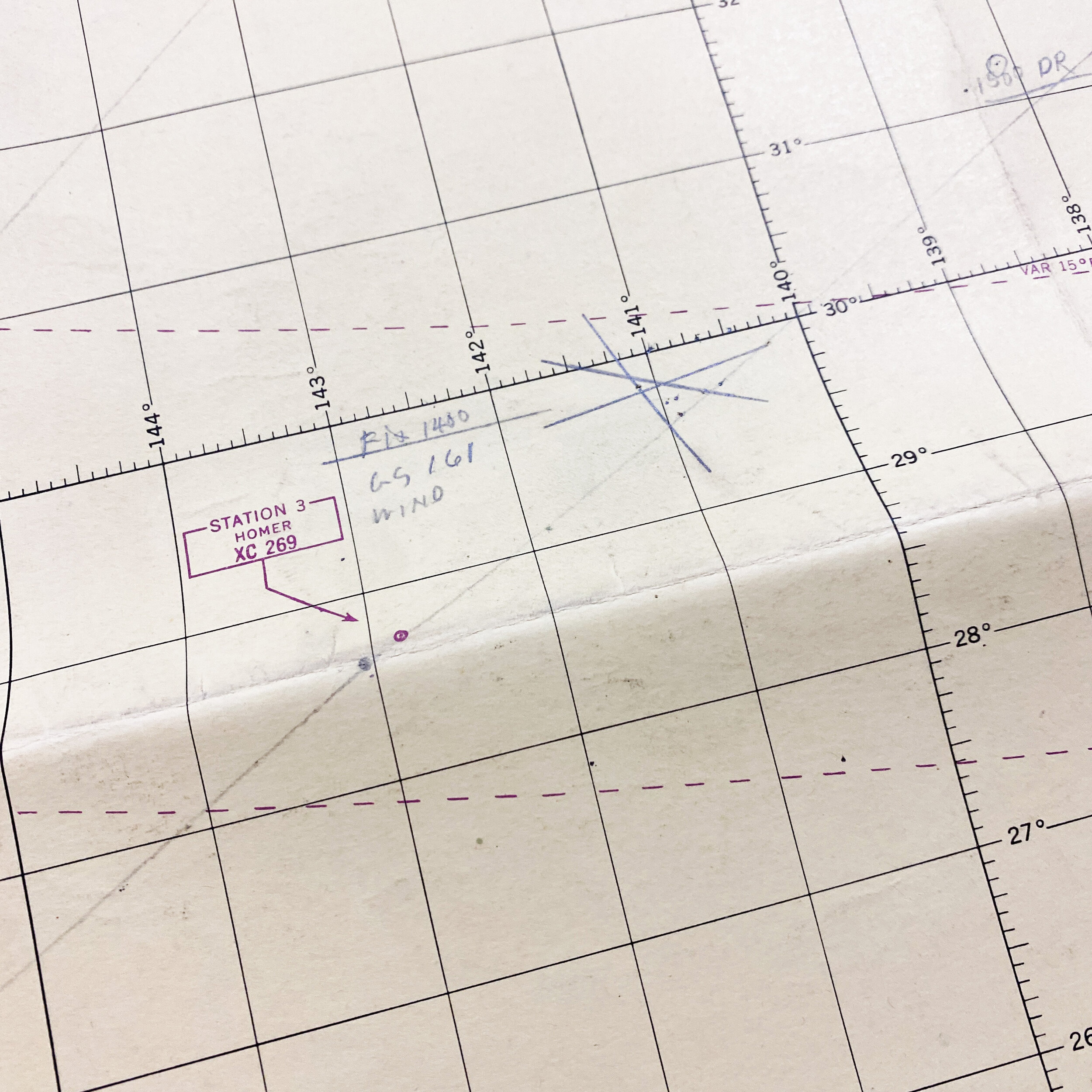
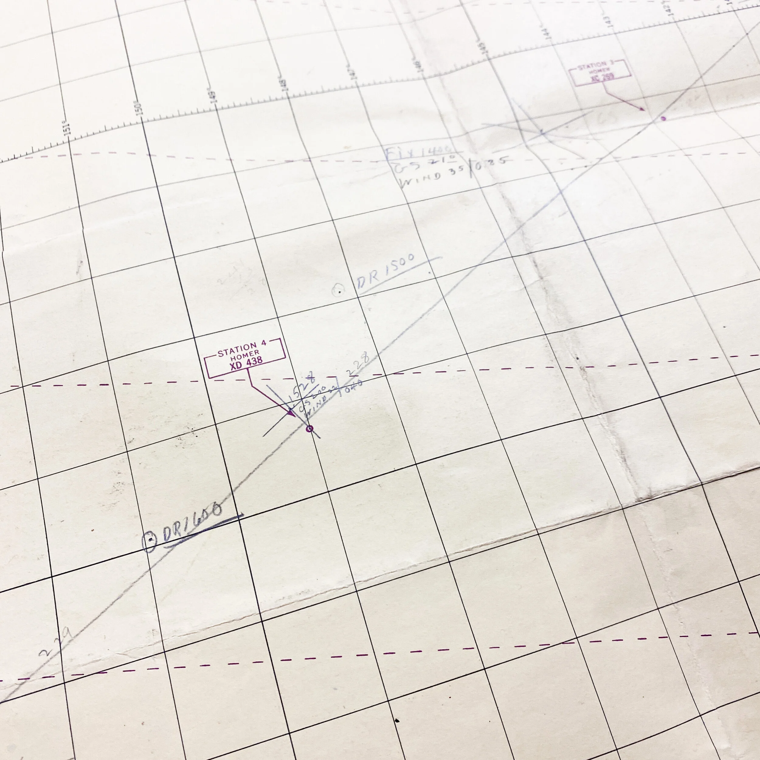
This WWII 1945 dated CONFIDENTIAL’ marked U.S. Navy air navigation Pacific Theater map was used by U.S. pilots and aircrew in the Pacific Theater. This map is the second edition printing of this map and is dated January of 1945, with corrected air navigation (purple charting lines) corrected as of July 4th, 1945. This map was created by the 30th Engineer Base Topographical Battalion. The map itself shows some the infamous island of Hawaii and Pearl Harbor which was attacked by the Japanese. This map is double-sided and shows the exact same map on the opposite side with many annotations on the front and back plotting wind speed, time, etc. from the navigator. While it is unclear why this map displays two of the same geographical faces (front and back) it maintains its role as a rare World War II and air navigational map. This map would have been extremely confidential and closely guarded as it gives many of the locations, and LORAN (LOng RANge Navigation) radio transmission signals of the Allied forces in the area.
WWII Advanced in Air Navigation:
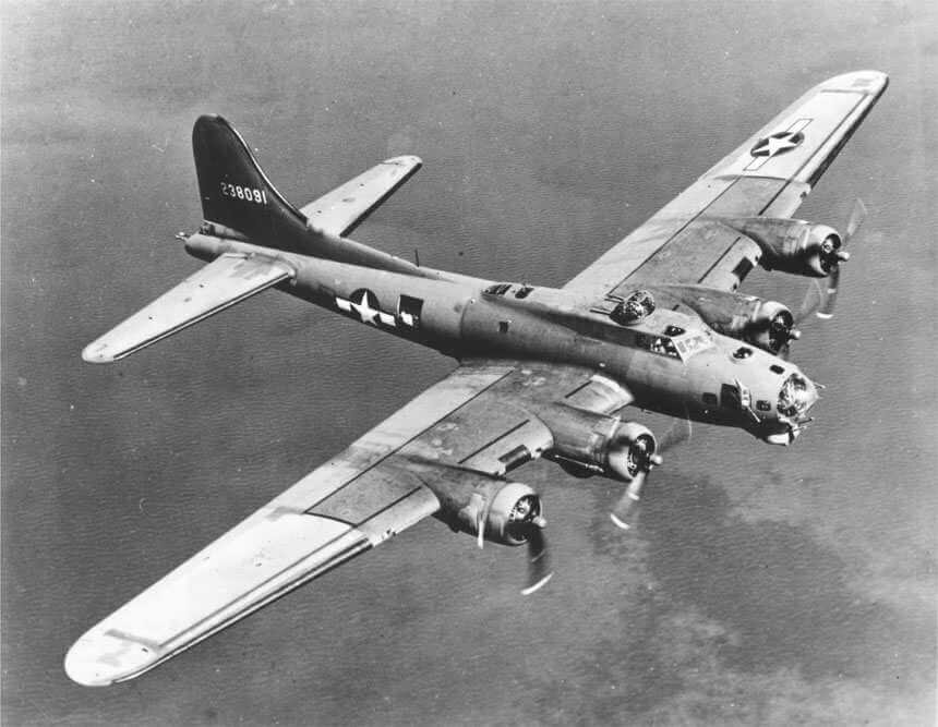
World War II spurred great advances in air navigation to meet the urgent needs of nations at war. Use the resources in this section to gain a deeper understanding of the people, tools, and technology of air navigation during World War II. World War II drove the United States to develop new navigational technologies. Pre-war navigational techniques were not suited for use in all-weather military operations or by the tens of thousands of inexperienced young navigators entering military service. Many of the tools and technologies developed then are still in use today. In particular, one technology became essential during the war and beyond. LORAN (LOng RANge Navigation) is system of radio navigation based on measuring the time-delay between sets of radio signals. The big advantage of this system over celestial navigation is that it was more accurate during the day and worked at night even when the sky was cloudy.