1945 U.S. Navy Amphibious P.T. Boat Depth and Geographical Map - Used during the Battle of Camotes
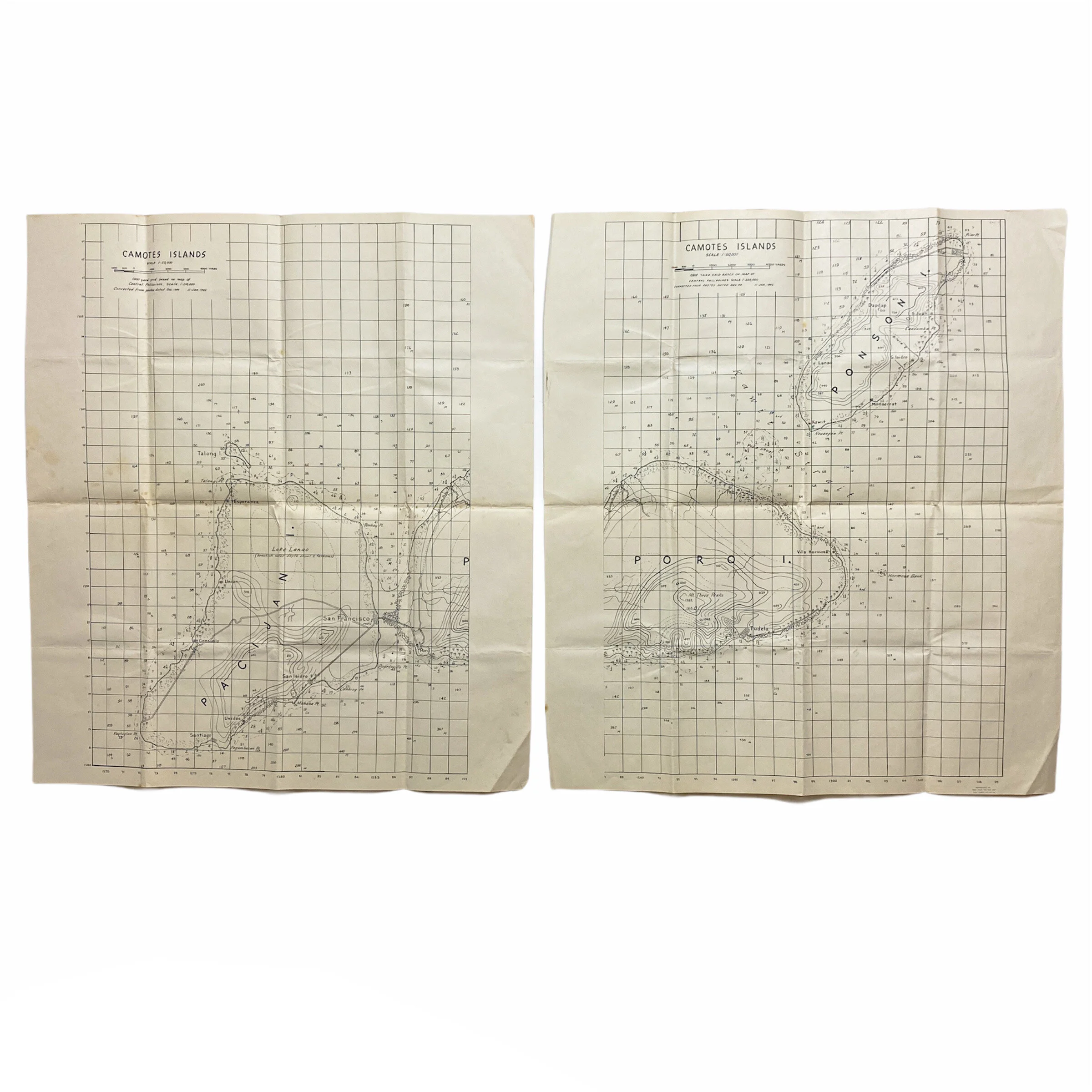


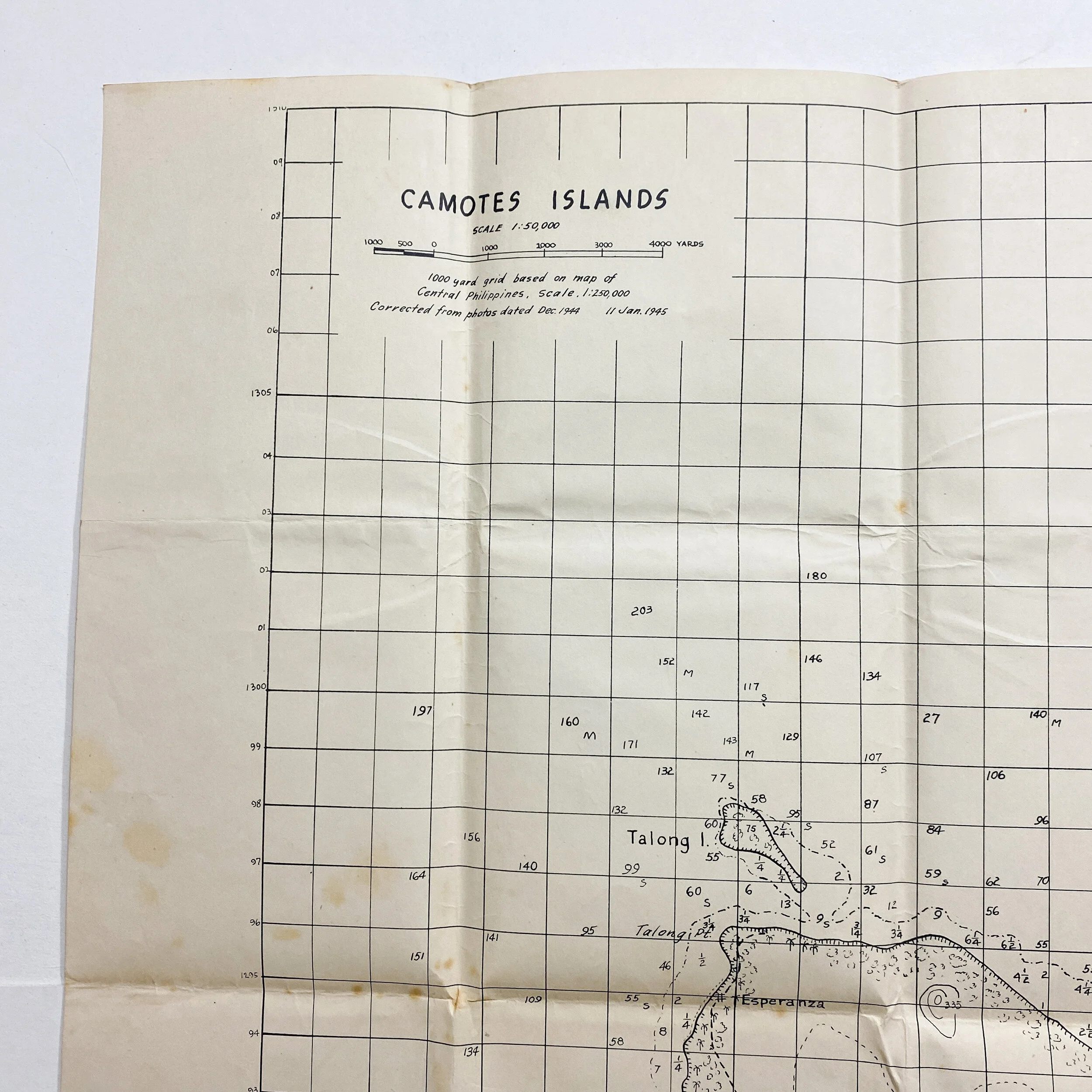

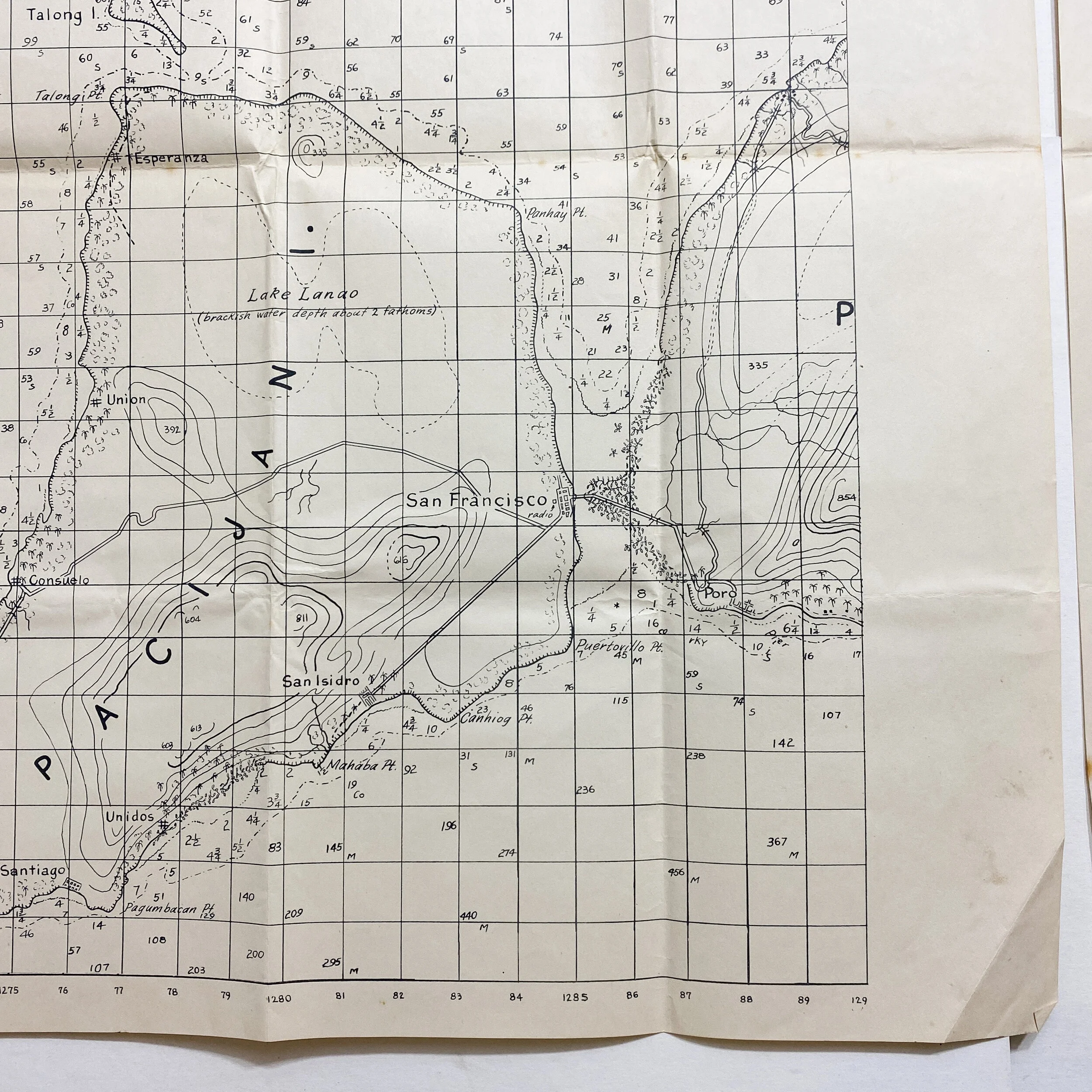


1945 U.S. Navy Amphibious P.T. Boat Depth and Geographical Map - Used during the Battle of Camotes
Size: 22.5 x 20 inches
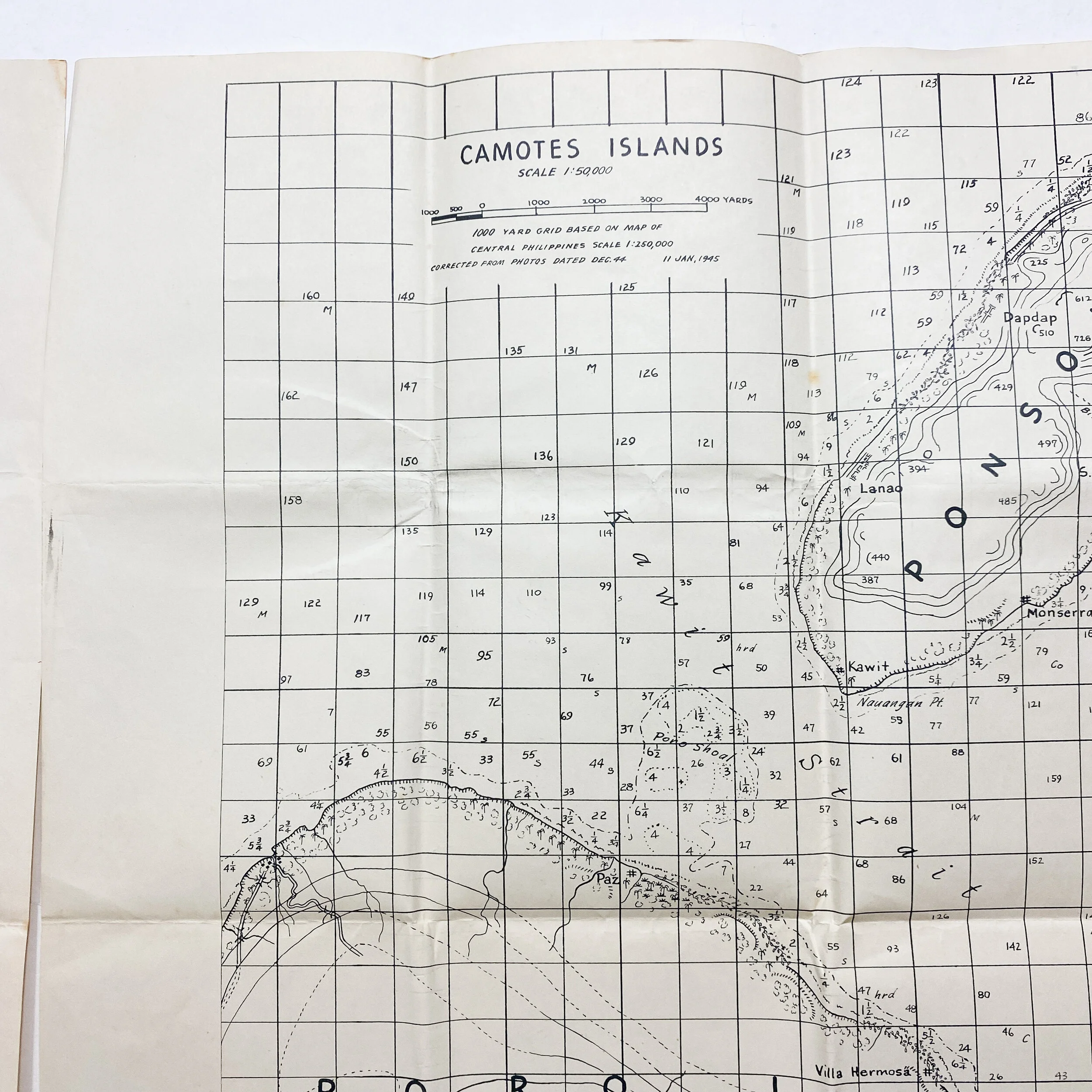
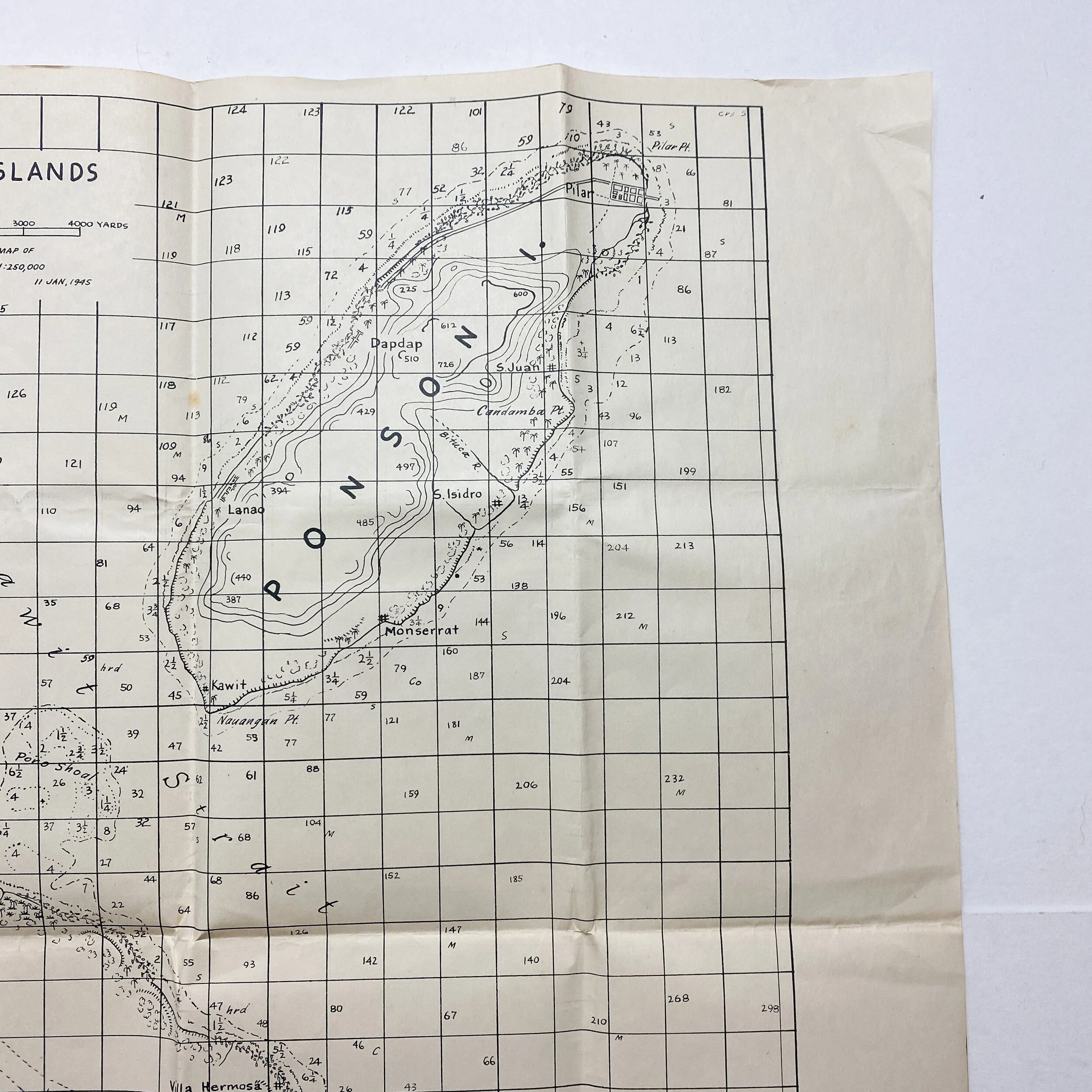
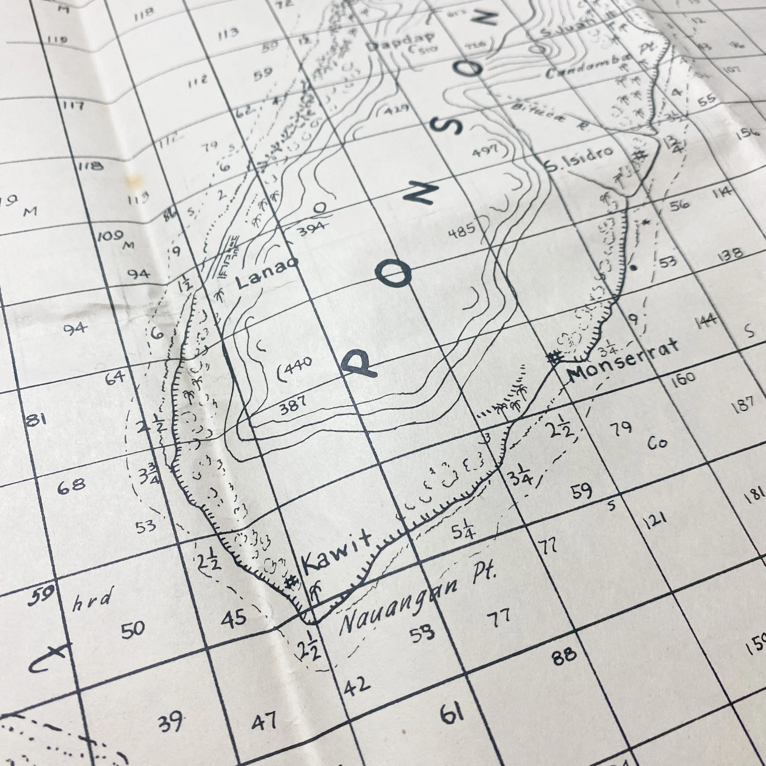
The Battle of Camotes Islands in the Pacific campaign of World War II was the amphibious invasion of the Poro Island in the Philippines by United States forces that took place January 15th through the 31st of 1945. These two maps titled “Camotes Islands” were constructed and corrected from photos being dated December of 1944. These photos were most likely flown from a reconnaissance plane prior to the invasion. This map is dated January 11th of 1945 and was most likely printed in the field (Pacific Theater). The map chose the entirety of the geographical islands controlled by the Imperial Japanese Army as well as the depths of the surrounding reefs and ocean.
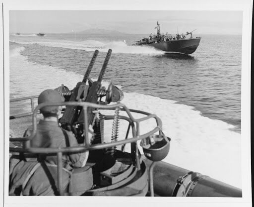
These maps were printed 4 days prior to the operation and were most likely used and carried by one of the 4 naval protection P.T. (patrol torpedo) boats under command of Lieutenant Commander Leeson. These boats carried the 7th Infantry Division whose objective it was to capture Ponson Island. Upon there amphibious landing, the team found the Ponson Island evacuated by Japanese, after landed unopposed on north and south tips of the island.
On the 18th of January,1945, the landing force has left the Ponson Island and established a beachhead on Poro Island. On January 19th, fire contacts with the Japanese garrison were reported. On January 23rd, 1945 a Japanese positions on "Hill 854" were encountered. The Japanese resistance was eliminated. The U.S. forces returned to Leyte on February 2nd, 1945. The control of Poro Island was given away to 2nd battalion of the 94th infantry regiment of the Commonwealth of the Philippines forces.