RARE! WWII 1944 Battle of Brest German Combat Map Captured by U.S. Soldier During Operation COBRA


RARE! WWII 1944 Battle of Brest German Combat Map Captured by U.S. Soldier During Operation COBRA
Comes with a hand-signed C.O.A.
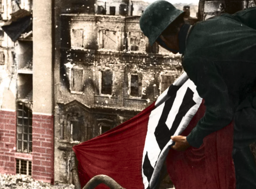
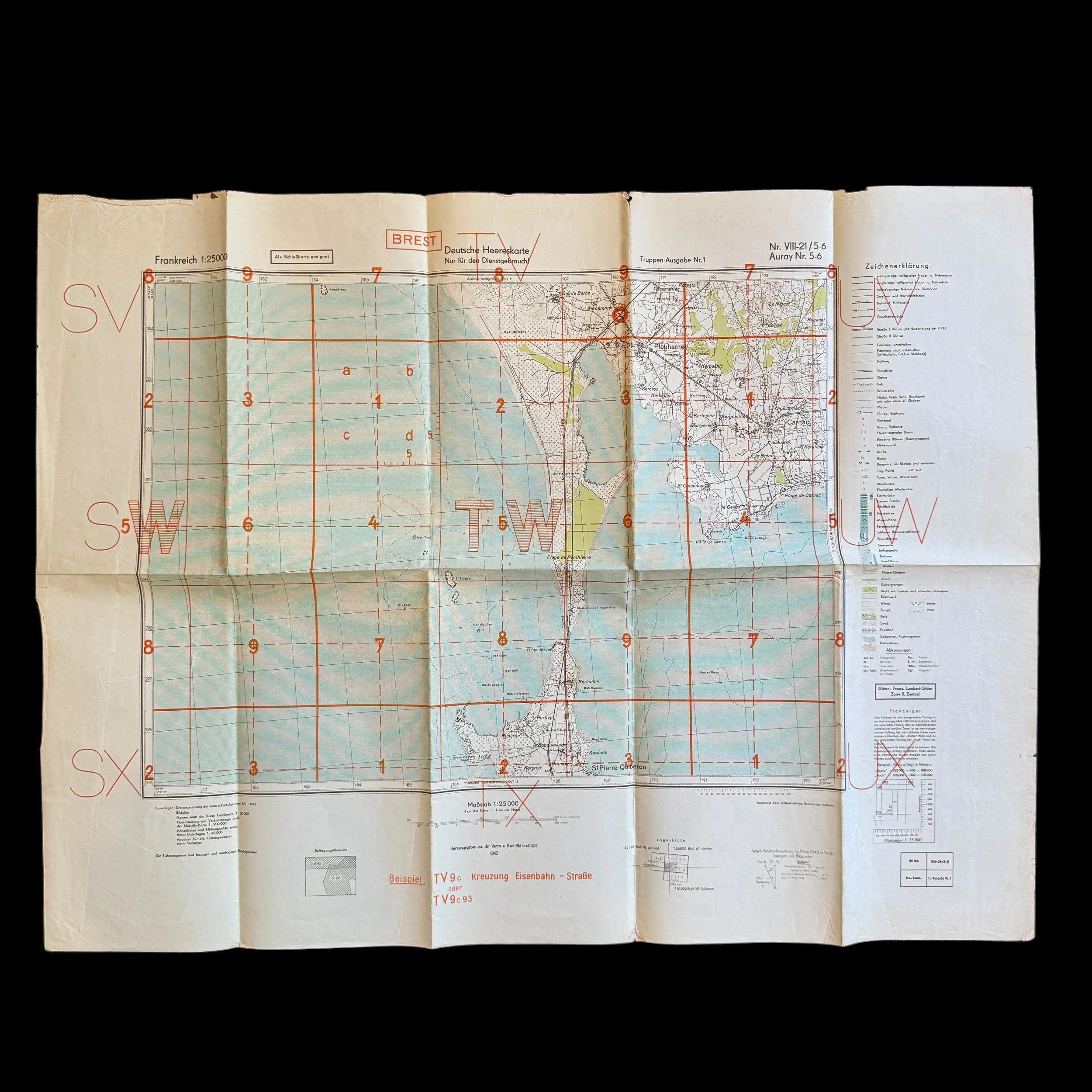
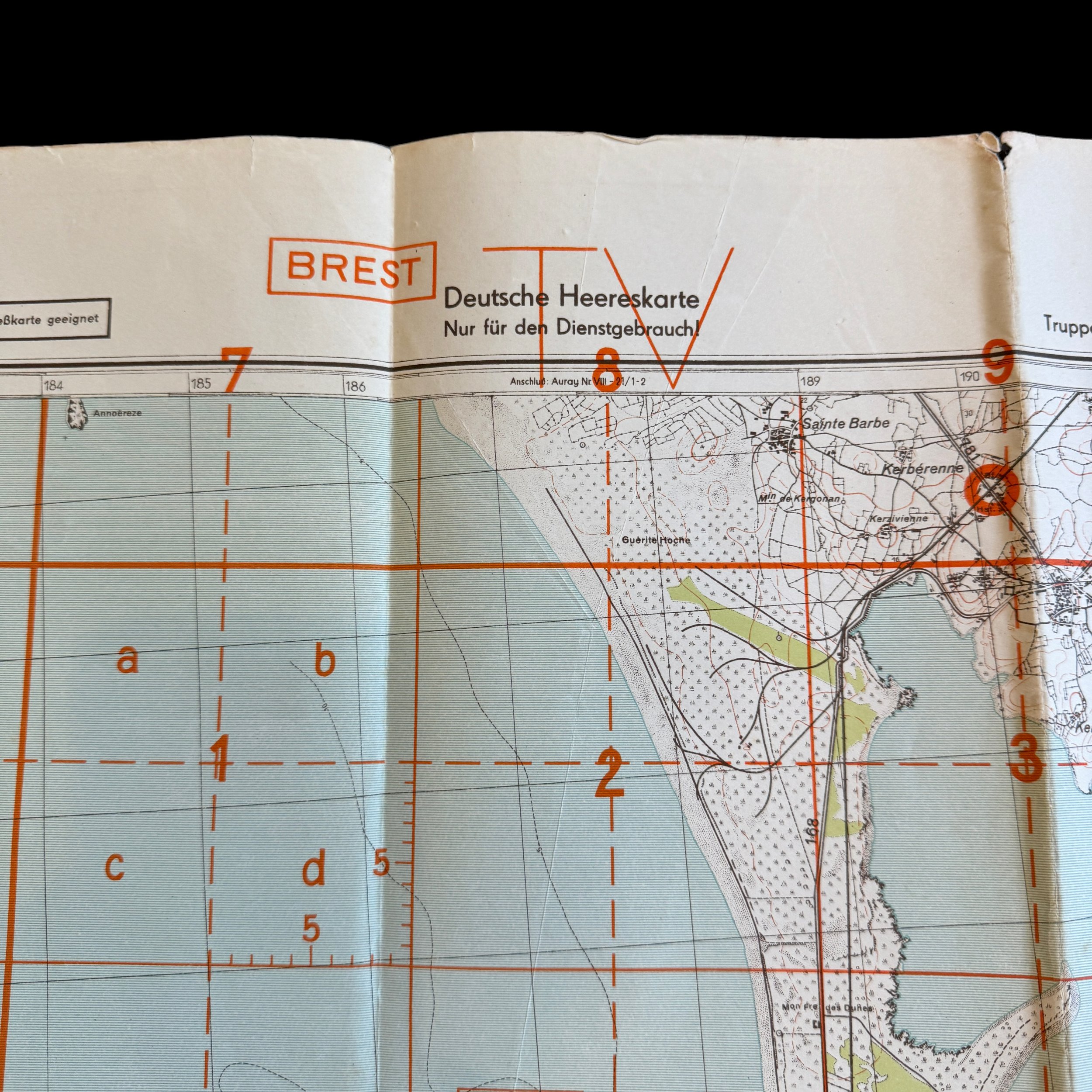
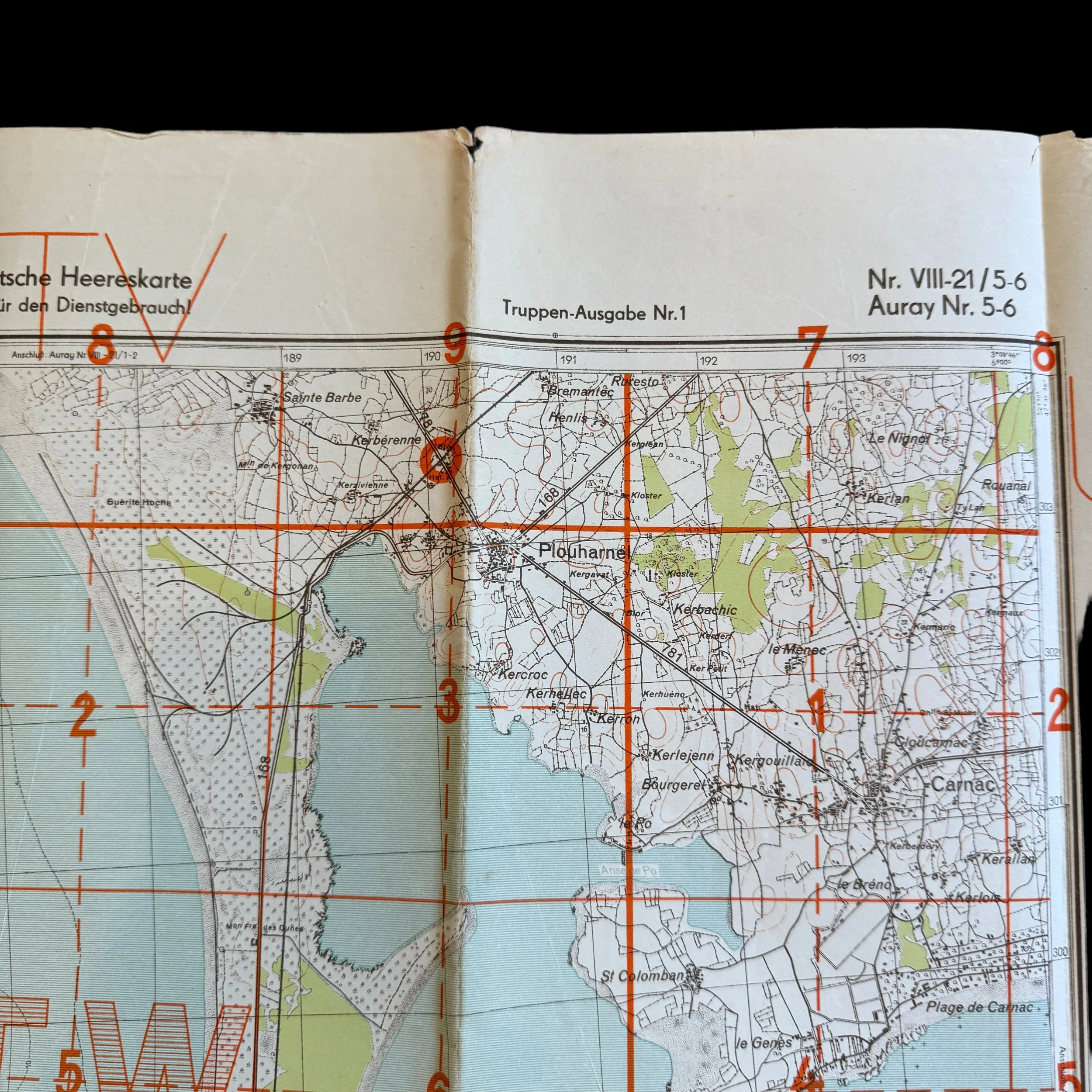
This rare and museum-grade WWII Battle of Brest German combat map comes from the bring-back collection of a U.S. soldier who served under the command of General Troy Middleton during Operation COBRA. Dated 1944 this updated German combat map was used by German soldier occupying the area of Brest, France during the Allied D-Day landings on June 6th, 1944. This map was captured as U.S. Divisions penetrated German lines and began to liberate more French towns across the Normandy region.
The Battle of Brest and Operation COBRA: Strategic Cartography in World War II
The strategic deployment and use of maps in military operations has been a cornerstone of warfare throughout history. During World War II, the importance of maps was underscored during significant operations such as the Battle of Brest and Operation COBRA. These operations not only highlight the tactical ingenuity of the Allies but also illustrate the role of cartography in shaping military strategies and outcomes.
Operation COBRA: Breaking the Normandy Stalemate
Operation COBRA, initiated in late July 1944, was the Allied offensive aimed at breaking out of the Normandy region after the initial landings on D-Day had bogged down into a war of attrition. The German forces, well entrenched in the Norman bocage (a pattern of small fields surrounded by dense hedgerows), proved difficult to dislodge. The U.S. forces, under the command of General Omar Bradley, devised Operation COBRA to punch through these defenses and exploit weaknesses in the German lines.
Maps played a pivotal role in planning and executing Operation COBRA. Detailed aerial reconnaissance and updated maps were crucial for understanding the terrain, which was characterized by the aforementioned hedgerows. These natural barriers, not well represented in pre-war maps, necessitated updated and precise cartographic intelligence. Allied cartographers had to incorporate rapid aerial photographic analyses to provide commanders with accurate and timely information. This ensured that artillery and air support could be accurately directed, minimizing the risk of friendly fire and maximizing the effect on German defenses.
The Battle of Brest: A Focal Point for Cartographic Intelligence
Following the breakout from Normandy, the Allies aimed to secure ports to facilitate the logistics of their advancing forces. The port of Brest, located in Brittany, was a major target due to its capacity to handle large amounts of cargo and its strategic position. The battle for Brest, lasting from August to September 1944, was marked by intense fighting and the extensive use of cartographic intelligence.
The importance of maps was dramatically highlighted when U.S. forces captured German maps of Brest and the surrounding areas. These maps provided valuable intelligence on German defensive positions and fortifications around the port. The capture of these maps was not merely incidental; it was a testament to the Allies' recognition of the operational value of accurate cartographical data. U.S. forces could adjust their tactical approaches by understanding the details of the enemy’s defensive layout, which was intricately depicted in the captured maps.
The German maps of Brest were particularly important because they included details that were not available or had been underestimated in Allied maps. These details included the depth and reinforcement of defensive structures, minefields, and artillery positions. This intelligence allowed Allied forces to refine their siege tactics, focusing their attacks on weak points in the German defenses and avoiding heavily fortified areas that would result in unnecessary casualties.
Tactical and Strategic Outcomes
The capture and subsequent use of German maps during the Battle of Brest facilitated a more effective bombardment and assault strategy. Allied forces, especially artillery and air units, could target specific locations with a higher degree of accuracy. This capability not only degraded German defensive capabilities but also preserved the infrastructure of the port to a certain extent, which was crucial for its use in subsequent logistical operations.
The strategic implications of Operation COBRA and the Battle of Brest extended beyond their immediate tactical outcomes. By breaking out of Normandy, the Allies were able to liberate much of France in a relatively short period. The capture of Brest, although costly, ensured that the Allies had a functioning deep-water port to support their operations as they pushed towards Germany.
The effective use of maps in Operation COBRA and the Battle of Brest showcases the integral role of cartography in military strategy and tactics. The capture of German maps during the Battle of Brest not only highlights the direct impact of cartographic intelligence on tactical decisions but also underscores the broader strategic importance of accurate geographical information in warfare. As seen in these operations, the ability to adapt to the dynamic cartographical realities of the battlefield can determine the success of military campaigns. The lessons from these World War II operations continue to influence modern military strategies, where technological advancements have further elevated the importance of precise and timely cartographic data.